Street View, Coming to a River Near You
New 360-degree map of Blackstone River is latest addition to growing catalog of visualizations of the waterway
September 29, 2025
Share
A few weeks ago, Bryce DuBois arrived at the Map Center in Pawtucket, R.I., to pick up an old-fashioned map of southeastern New England that he could show his students at the University of New Haven, where he is an associate professor.
He came out with a camera and a plan to make a modern map himself.
Map Center owner Andrew Middleton and DuBois had gotten to talking, and when DuBois mentioned that he was going to paddle the 48-mile Blackstone River, Middleton insisted that DuBois borrow his GoPro camera to document the historic body of water.
“‘Take this camera along with you and collect some imagery along the way, and now we’ll have Street View data in a way that Google never would have,’” Middleton recalled telling DuBois.
The new 360-degree map of almost the entire Blackstone is just the latest addition to a growing catalog of visualizations advocates for the river have created to both learn about the waterway and share that knowledge with the public.
“If you’re a person who is curious about what it’s like to go paddling on a beautiful historic waterway that maybe you’ve passed by all your life, but you never really thought to get out, you know, explore yourself,” Middleton said.
Now with the online map, you can. The process of making the map using software called Mapillary is relatively easy and free to use, Middletown added.
Although Middleton lent his GoPro for the Blackstone map — a camera he received through a Mapillary grant — a smart phone camera works fine, too.
For the Blackstone paddle, Middleton showed DuBois how to mount the camera onto a watercraft and set the frame rate to adequately document the river from the water.
The whole mission of Mapillary is to try to create a street-view map of areas that Google and other commercial map-makers don’t bother to capture because it wouldn’t be lucrative. (Middleton noted that Meta did recently acquire the organization, though it is still a nonprofit.)
“I’m deep into map land, and so I’m really invested in, like, the politics of maps, which sounds kind of silly, but it’s actually fairly intense, depending on where in the world you are,” Middleton said. “There’s a big difference between making a map and being mapped.”
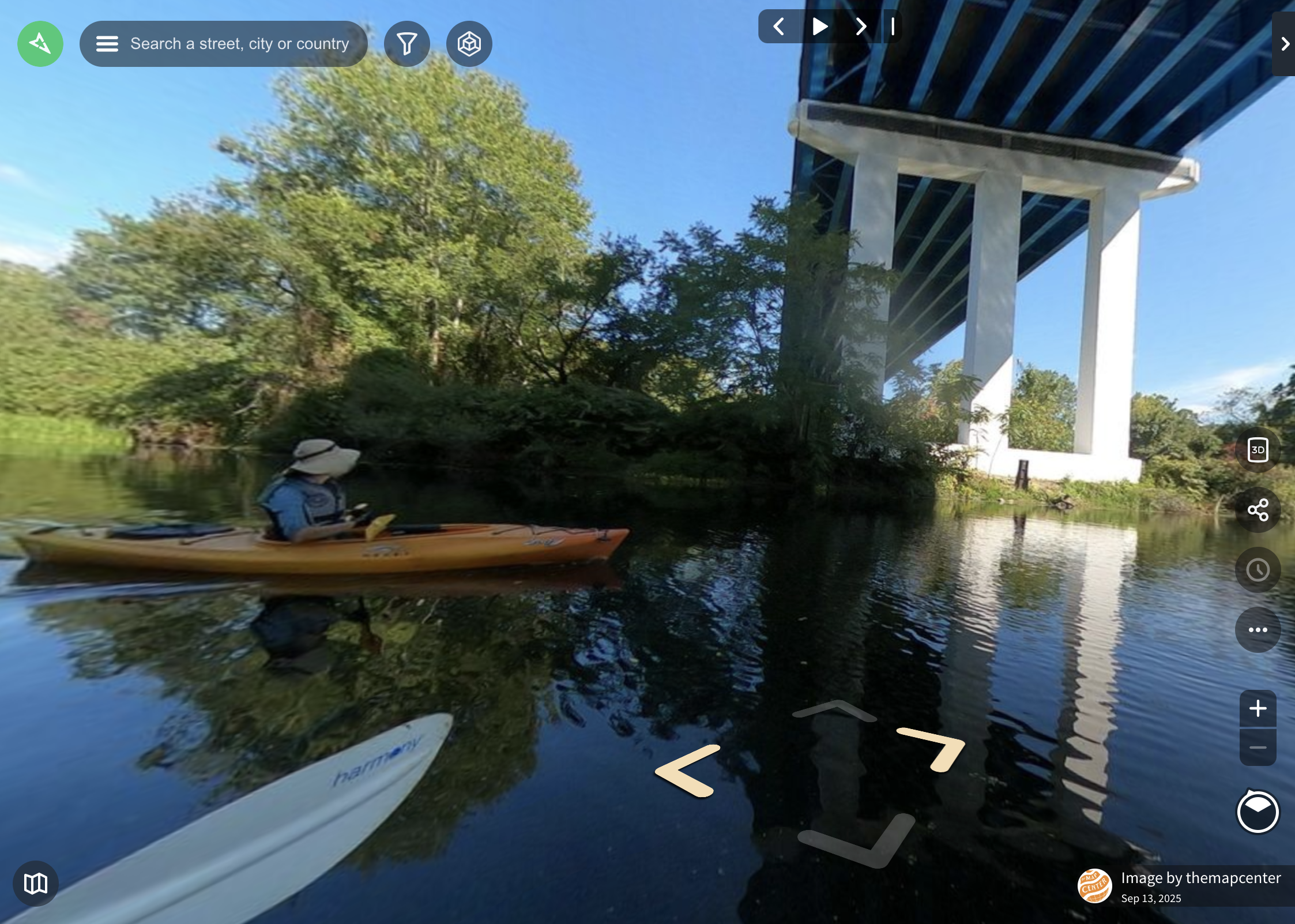
After the Blackstone River footage was collected over the weekend, Middleton said it took about an hour to upload, and Mapillary blurs faces and license plates in the footage. Then, it was done — almost an entire map of the Blackstone River finished in an afternoon.
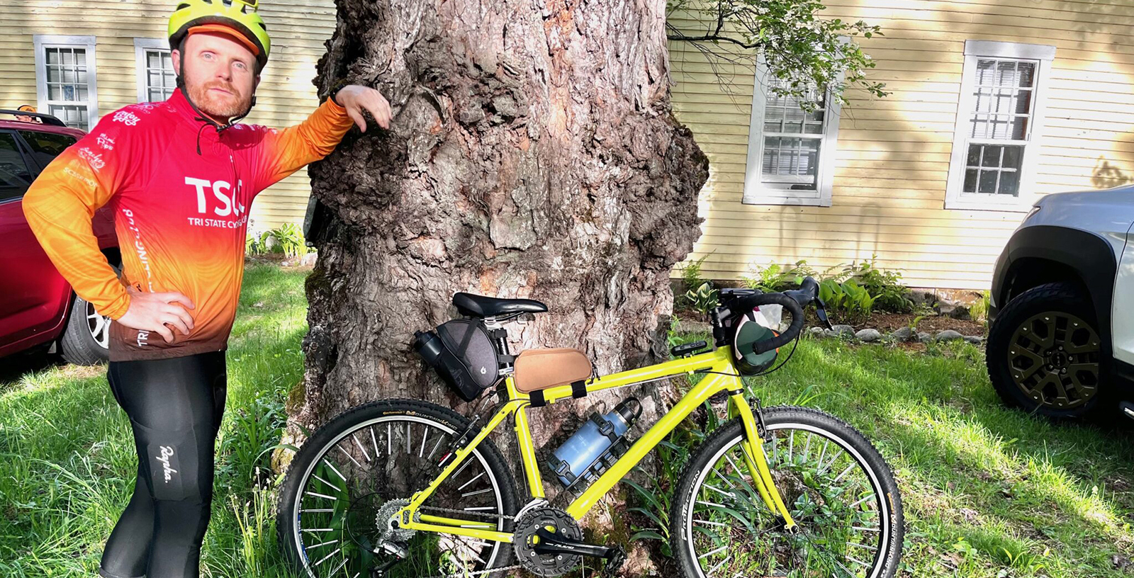
DuBois said he missed a few spots, mostly because of the limitations of battery power and because one of the paddlers who had the camera mounted on his kayak capsized when he encountered a downed tree. (The camera man is OK, he noted.)
An environmental psychologist and a board member of the Blackstone River Collaborative, DuBois said he believes the map will help all those who care about and advocate for the river have the data they need to actually plan ways to improve it.
The map displays a kind of “groundtruth” about the negative and positive realities of the Blackstone, he said.
Middleton agreed. “We can use that imagery to be persuasive, to convince people to go out on the water, to protect a beautiful resource that maybe they’ve overlooked, and also to make a compelling case to local policymakers.” Middleton plans on lending the camera to other organizations to make maps of other bodies of water.
The paddle shown in the 360-view map was the third annual paddle organized by the Blackstone River Commons project and the Blackstone River Collaberative, according to Commons co-founder Emily Vogler.
“It was both a really inspiring trip in terms of seeing what felt like an improved health of the river, improved access to the river,” said Vogler, who is a landscape architect and a professor at the Rhode Island School of Design, “but also some parts that were, you know, sad to see that there still are so many challenges, specifically related to some of these water quality issues.”
Vogler has been championing access to the river for years as a part of the Commons project, which collaborates with The Blackstone River Watershed Council/Friends of the Blackstone and the Collaborative.
The 360-degree map is just the most recent iteration of a process they’ve been working toward: bringing the river to the people and helping them get to know it.
Although the river is relatively difficult to access, Vogler helped create a paddle guide to show the public access points where paddlers can put in kayaks and canoes. It also shows where each of the 19 dams on the river sit, so that paddlers know where they have to drag their boats out of the water, lest they accidentally and dangerously sail right over one of the obstructions.
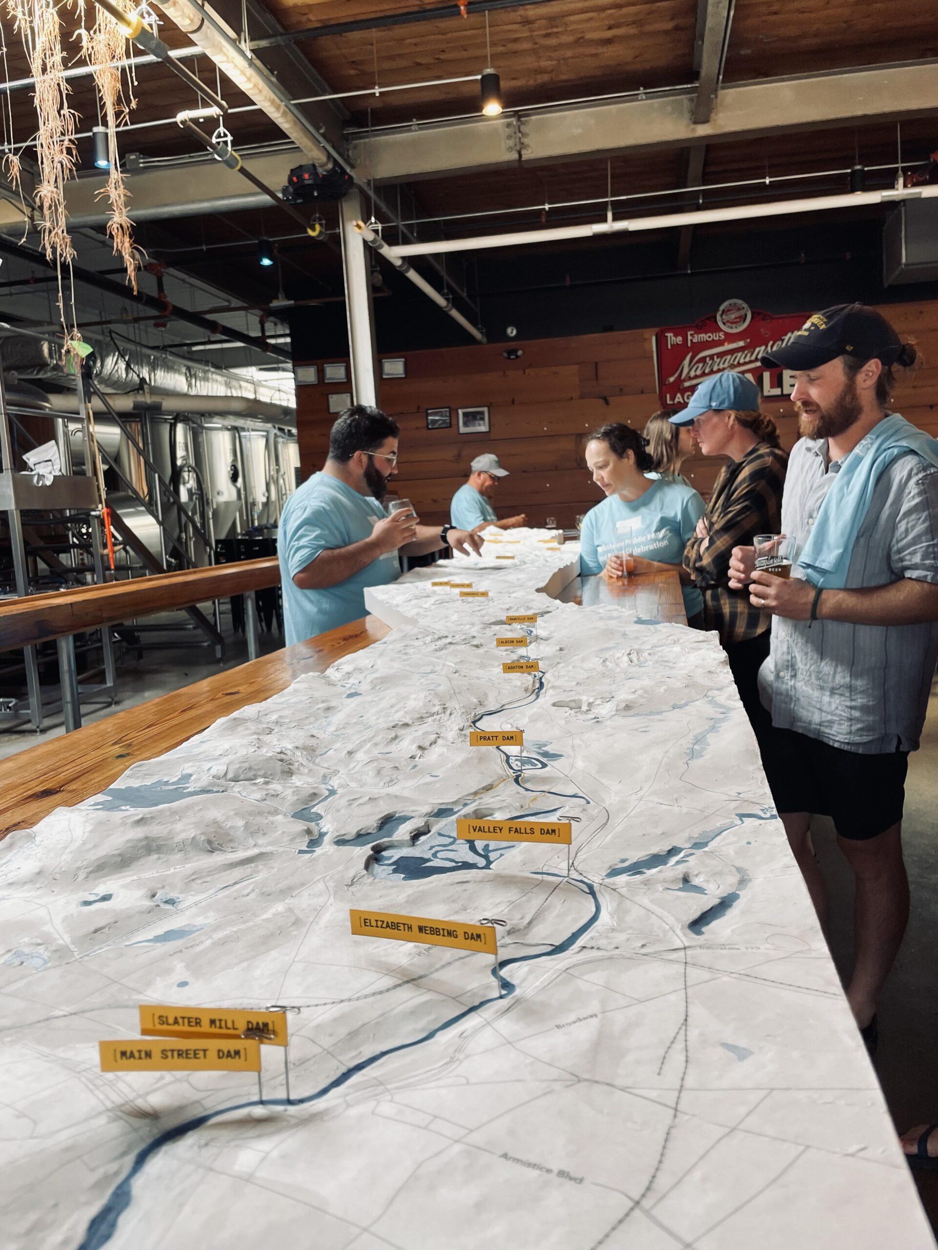
One of the latest and perhaps most ambitious undertakings is a 25-foot-long, three-dimensional model of the river.
“It’s a showstopper,” said Vogler, calling the model a bit of a “magnet,” drawing in those who might not usually be interested in learning about the Blackstone.
Vogler has been working on the model for a few years with the help of a team of people including Vogler’s student Sophie Kaplan-Bucciarelli and Brown Design Workshop’s Ben Lyons, who helped troubleshoot the model’s surface.
For Vogler, the 3-D model helped her wrap her own head around the river, so that she can better understand whether and how its conditions can be improved. The 360-degree view adds to that, filling in gaps in the information they already have.
“It’s only 48 miles, which is shorter than most rivers, but there’s a lot of different conditions that exist,” she said.
Plus, when she’s on the river, there are only so many notes she can take — and even though she does have her clipboard out, it often doesn’t survive the paddles without getting wet and at least a little muddy.
In addition to providing data, the models and maps also “let other people travel the length of the river” who for myriad reasons wouldn’t be able to otherwise.
The 360-view of the river is available online. The 3-D map made its debut at Narragansett Brewery in Providence after the recent paddle and will continue to be used as a tool for outreach as Vogler and others kick off the Kittacuk Restored project, which will start with a public meeting later in the fall.

This is very cool