Siting of Renewables Divides Rhode Island’s Land and People
April 4, 2019
FOSTER, R.I. — The faces and decor were different, but the conversation was virtually the same. Eight months and some 30 miles separated the two living-room meetings, but the 25 people who had gathered, some friends and others first-time acquaintances, were all stunned by what had been proposed for their rural neighborhoods.
The 12 people who gathered on a recent Sunday evening at Amita Rodman’s Tucker Hollow Road home sipped wine and shared worry about a utility-scale energy project proposed for Hartford Pike. Their concerns mirrored those of the 13 people who had gathered on a Saturday morning last summer at Joe and Paula Moreau’s home on Old Depot Road in Hopkinton.
Neither group had expected industrial-scale facilities to be sited in the woods and wetlands that surround their homes.
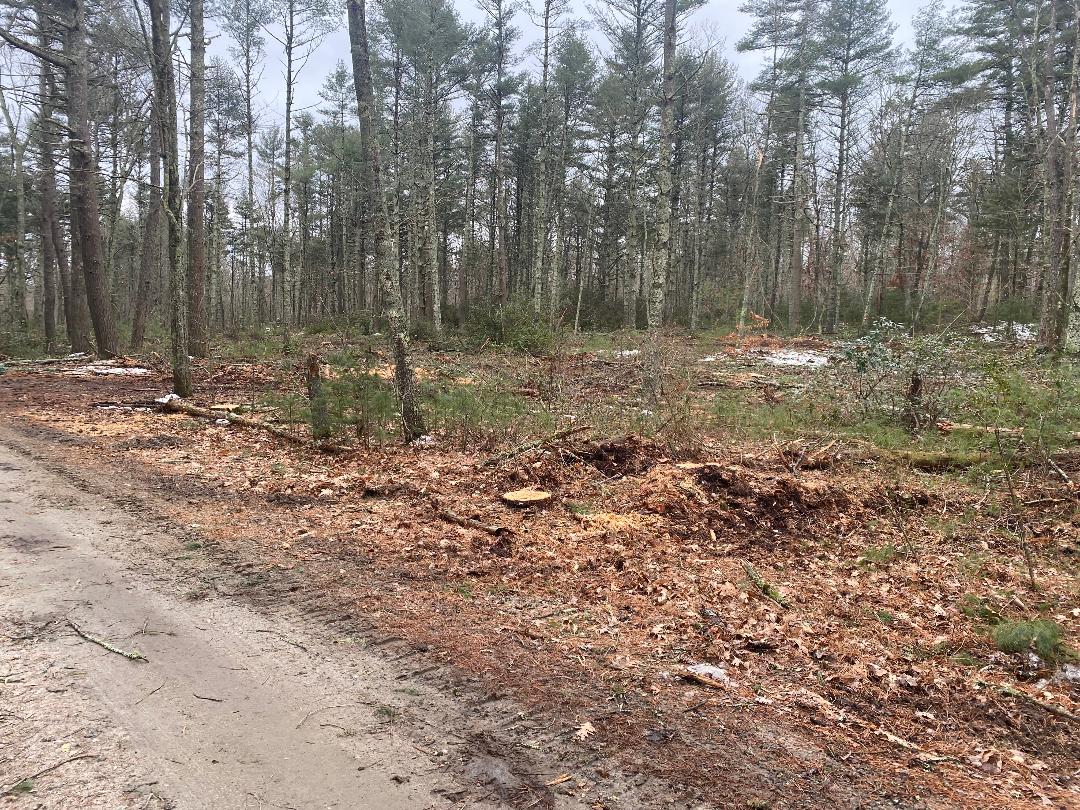
The 6-megawatt ground-mounted solar facility proposed for Hartford Pike is expected to be enclosed by a 9-foot-high security fence. More than 20 acres of the 45-acre site would be clear-cut to make room for the panels and their related equipment, such as inverters.
In Hopkinton, it was the proposed installation of thousands of solar panels on nearly 62 acres of private forestland off Route 91 to generate 13.8 megawatts of electricity that sounded the alarm.
During the past two-plus years, residents in Coventry, Cranston, Exeter, Glocester, Portsmouth, Richmond, and Tiverton, among other communities, have been debating the merits of siting renewable-energy projects, most notably ground-mounted solar arrays, on open space versus the need to decrease our reliance on fossil fuels.
Some public meetings have become boisterous. Lawsuits have been threatened. A stakeholders group was created, and opposition groups were formed. Legislation has been filled, and Statehouse hearings have been held.
Opponents of clearing open space to make way for renewable-energy projects say the state should better direct such development to commercial rooftops, parking lots, brownfields, and other manmade space that is underused or vacant. Developers say it’s more complicated and expensive to reuse already-disturbed space.
The sensitive subject has pitted town councils against planning boards and planners. The controversial siting issue has even divided environmentalists and stressed friendships.

Monique Taylor, Tim and Lisa Harkin, and the nine other people who traveled the dirt road to Rodman’s house on the last day of March claimed that the Planning Board and Zoning Board of Review pushed the solar project through last spring. Similar claims have been made by residents across Rhode Island, as cash-strapped municipalities have embraced the idea of tax revenue generated by large-scale solar projects sited in residential neighbors, in woodlands, and on farmland without fully considering the overall impact.
A since-deleted Facebook post by Planning Board chairman Ron Cervasio, which was saved by Taylor, a Hartford Pike resident, captures the type of simplicity often applied to this complex issue.
“what I find most interesting is people who worry about global warming are against solar and wind energy next to their house. if you like the property next door the way it is, buy it. this town is desperate for revenue, the solar farm increase the town tax revenues, so people who complain about their taxes should love solar farms. the older I get the more confused I become,” Cervasio wrote.
None of the dozen Foster residents ecoRI News spoke with last month complained about their current tax bills, although some acknowledged the town’s financial limitations. Several, however, said they choose to pay the $6,500-$7,000 annual tab because it provides them woods, wetlands, and wildlife.
They said the proposed Hartford Pike solar project threatens three of the things that brought them to Foster. They’re concerned that the clear-cutting of 20 acres will drive away wildlife, such as bald eagles and bobcats, and that stormwater runoff from a barren site will alter wetlands and pollute nearby Dolly Cole Brook, a designated trout waterway by the Rhode Island Department of Environmental Management. They have requested that an environmental impact study be done.
They’re also concerned their property values will suffer and about the width of the proposed setbacks. They say the project goes against the town’s comprehensive plan — a common refrain that has echoed from Aquidneck Island to Exeter during the past few years.
A draft version of the town’s updated comprehensive plan notes that, “Threats from future residential, commercial or industrial development include degradation of water supply and water quality, increased light and sound pollution, loss of open space and increased habitat destruction. … Care should be taken to ensure that any such projects do not jeopardize any of Foster’s natural resources. Responsible development will provide the best protection for these resources.”
Foster resident Paul Allen was among those at the March 31 gathering at Rodman’s home. For some time he has been an outspoken opponent of using open space for solar-energy development. He has told local officials multiple times that, “Any policy that advocates deforestation or forest fragmentation and the destruction of habitat for wildlife and humans is bad design.”
In an October 2015 letter to the editor published in the Providence Journal, Allen began, “The end of the last rural town in the most urban state has come. The spendthrift Town Council, desperate for revenue, unanimously voted to approve a new zoning ordinance allowing industrial large scale solar arrays in Foster.”


Foster residents against this project need to check out the RI DEM 2015 Wildlife Action Plan’s "Conservation Opportunity Areas" map. They will note that a "Wildlife Corridor" crosses the site from north to south, linking a "Natural Heritage Area" to the interior forest north of the Pike with an NHA in the interior forest south of the pike.
A Wildlife Action Plan is required of states if they want to apply for conservation land acquisition funding from the US Fish and Wildlife Service. The federal funding comes from the Federal taxes paid by sportspeople purchasing sporting arms and ammunition, bows, arrows, etc. WAP’s must be updated every ten years. A WAP lays out a state’s master inventory and master plan for the conservation of wildlife.
At the Energy Facilities Siting Board hearings for the Burrillville power plant proposal, the Clear River Energy Center, the testimony of the expert environmental witnesses for the parties—Jason Ringler for Invenergy; and associate director, Scott Comings, of the Nature Conservancy, and Anthony Zemba for the Town of Burrillville, and deputy wildlife division chief, Jay Osenkowski, for DEM—centered their testimony on the WAP, it’s Conservation Opportunity Areas map, and TNC’s regional climate change resilience habitat map whose object is the preservation of wildlife corridors to accommodate the migration of species as the climate warms. There is a wealth of detail in their testimonies that all the people concerned about the western RI solar energy land-rush would profit by viewing their testimonies archived by the EFSB.
One interesting thing is that Invenergy’s lawyers hammered away at Osenkowski about the T. of Burrillville’s lack of response to DEM’s outreach efforts during the last revision of the WAP. Osenkowski testified that response from most western RI Planning Boards and Conservation Commissions was minimal and indifferent. Hence, in all the reporting I read here at ecori on the solar energy land rush, there has been no mention of the WAP and the data and tools it offers–especially the COA map—that can be utilized to develop rational and environmentally effective solar development regulation.
Start with Osenkowski’s testimony, then Comings, then Zemba. (Osenkowski and Comings testified for only one day while Zemba testified for two. So you want to the smallest and most comprehensive bite first.)
The media, too, would do well to explore this connection between the Burrillville power plant saga and the solar land rush, especially the crucial "non-jurisdictional uplands" aspect of the dilemma . It’s hiding in plain sight.
This story provides a link to Foster’s Comprehensive Plan…
Check it out, its the 2003 Plan.
It expired in 2011!
Comprehensive Plans are supposed to incorporate the lastest information from the latest state Wildlife Action Plan. That would be the "RI DEM 2015 Wildlife Action Plan."
Yes, something is smelly in Foster…
Deforestation for solar dramatically reduces the carbon benefits of solar. Until every parking lot and roof is covered, we should not be removing forest for solar panels.