R.I. Must Ensure Development of I-195 Land Isn’t All Wet
Sea-level rise major concern that must be addressed before building begins
July 29, 2015
Share
PROVIDENCE — Development of the freed-up Interstate 195 land is often touted as a cure to Rhode Island’s economic woes, but there is a limit to what these 19 acres — 24-plus, if parkland is developed into, say, a baseball stadium — can realistically provide.
The 5 or so acres where a minor-league ballpark has been proposed, for instance, are in a low-lying area that is susceptible to a foot of sea-level rise. In fact, much of the area — developed or not — is threatened by rising seas, according to James Boyd, coastal policy analyst with the state’s Coastal Resources Management Council (CRMC).
The Providence River unevenly splits the I-195 land into east and west parcels, and the area is protected from hurricanes and storm surge by the Fox Point Hurricane Barrier. This available-for-development land lies within both the Providence River and Narragansett Bay watersheds.
These watersheds are already impacted by dense development and large expanses of impervious surfaces, such as roads and roofs. Water-quality impairments in surface waters have been linked to watersheds with impervious cover as low as 10 percent. The Providence River watershed is about 30 percent impervious surfaces and the much-larger Narragansett Bay watershed is about 14 percent. The Providence River is on the Rhode Island 2012 list of impaired waters for nitrogen, dissolved oxygen and fecal coliform.
Those factors don’t make the I-195 land off-limits to development, but sea-level rise is a threat that must be incorporated into whatever is built, Boyd said.
“Sea-level rise is a concern … a big one,” he said. “Human-induced global warming is accelerating ice-sheet melt. The ramifications will be pretty incredible.”
The effects will be felt here. They already have.
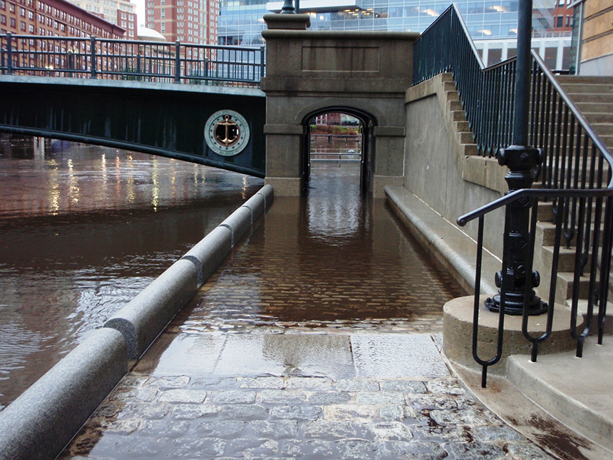
Seven years ago, a freak storm event gave Providence a glimpse of what 3 feet of sea-level rise will do. On the morning of Dec. 12, 2008, the Providence tide gauge recorded 2.7 feet above mean higher high water. This increased amount of water inundated parts of Waterplace Park along the Providence River, flooding river walkways and some ground-floor offices.
Boyd said that flooding — caused by an offshore low-pressure system that produced wind speeds of up to 53 mph and occurred during a moon tide — is representative of 3 feet of sea-level rise, likely before 2100, that will render current Waterplace Park walkways impassable except during the lowest tides.
He said any development project proposed for the I-195 district — or any other coastal development, for that matter — should incorporate at least 3 feet of sea-level rise into the design. Buildings should be elevated, with perhaps some parking space underneath, and utilities installed up high.
“The impact will be there,” said Boyd, noting that the hurricane barrier does nothing to protect the city from rising seas. “It’s cheaper and more intelligent to build with sea-level rise taken into account than spending a lot more later to retrofit.”
Jan Brodie, executive director of the I-195 Redevelopment District Commission, said sea-level rise and storm surge will be addressed in any development project. She noted that local and state zoning ordinances will be followed and CRMC guidelines and mandates incorporated.
Climate-change impacts, however, were ignored when it came to the initial design of a proposed pedestrian bridge that would connect both sides of the I-195 land.
“It was smart to use existing infrastructure in the design of the bridge, but sea-level rise wasn’t considered,” Boyd said. “There’s serious problems with the design. Elements of the bridge would be submerged twice a day during high tide.”
It has been reported by several media outlets that the proposed bridge would be elevated another foot or so to accommodate the rising sea. However, Boyd and Laura Dwyer, CRMC’s public educator and information coordinator, both said the agency hasn’t received any revised bridge plans.
Without seeing new project plans, Boyd said he doesn’t know if another foot of elevation would keep the bridge dry.
The I-195 Redevelopment District Commission was created in late 2011 to serve as the authority responsible for the sale, marketing and oversight of the land made available by the interstate’s relocation.
The 169-page redevelopment and marketing analysis for the I-195 land addresses floodplain issues, such as requiring the lowest floor in certain zones to be elevated to or above base flood level.
There are also other implications to consider when it comes to development in this area. If a baseball stadium were to be built on the nearly 5 acres of parkland in Parcel 4, for example, the same amount of land elsewhere in the district would need to be set aside as open space to meet stormwater management mandates and to avoid losing federal highway funding.
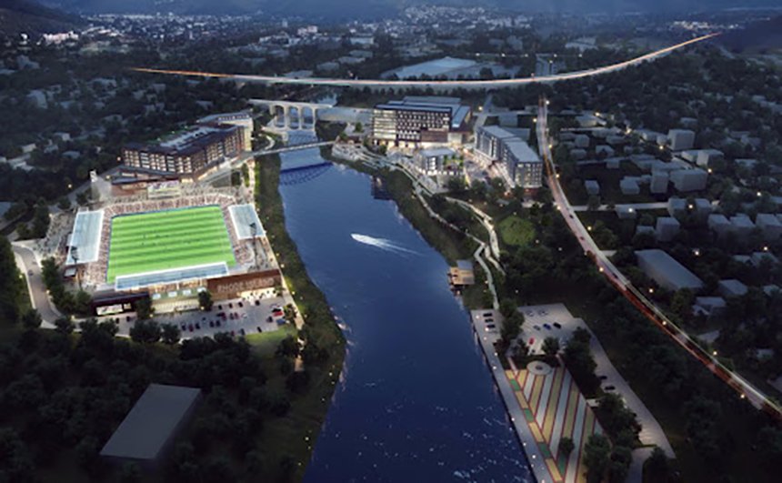
Besides the ballpark idea being trumpeted across the state by Pawtucket Red Sox and Boston Red Sox officials, other development possibilities mentioned have included a proposal by a Dallas-based developer to build privatized student housing and Gov. Gina Raimondo’s Rhode Island Innovation Institute idea.
Brodie said the area could accommodate up to 4 million square feet of development, noting that interest has come from the residential, hospitality and entrepreneurial fields. She also has noted there are development challenges attached to the I-195 land, such as building costs as high as in Boston and New York City without the ability to generate the same revenues.
“We hope to have great low-impact design that incorporates such things as rain gardens and LEED certification,” said Brodie, noting that only a few areas of the district are likely to be impacted by sea-level rise. “We want to be green with a capital G.”
Thanks for the first fact-based, rational report I’ve seen regarding the I-195 development project. The clear map, complete with parcels indicated, is a treasure. Has this information appeared in any other media reports?
It should be required reading and placed in the mailbox of every RI legislator.
Maggie Bulmer