On the Edge: Marshes, Oysters and Waterfront Homes
Intense summer heat, warming waters, shifting seasonal patterns, loss of native species, and stronger coastal storms threatening Narragansett Bay
September 20, 2017
Share
This year’s Watershed Counts report again describes a bay and shoreline under duress and facing an uncertain future. The causes aren’t new, but the overarching threat to the Narragansett Bay region is climate change. To illustrate the current and future perils, the report analyzes three topics: oysters, saltwater marshes and waterfront homes. The three make for an ideal summer setting in Rhode Island, but from an ecological perspective they are on the cusp of significant change.
Marshes
The report’s profile of saltwater marshes is compelling for its clear illustrations and concise description of one of Narragansett Bay’s most underappreciated resources. Marshes teem with ecological diversity and provide important functions such as sequestering carbon, filtering pollution, and protecting the shoreline from floods and erosion.
Yet, sea-level rise is submerging these habitats faster than they can naturally elevate themselves. Since 1999, the water level in the bay has risen 3 inches, compared to a 1.125-inch accretion rate for marshes. As water becomes trapped atop marshes, the grasses turn to mudflats and eventually open water. According to the report, if sea-level rise increases 5 feet, as projected, the bay will lose 87 percent of its remaining marshes.
Experimental marsh preservation projects are underway in Middletown, Charlestown and Narragansett. To elevate marshes, sediment from dredged navigation channels and breachways is sprayed on top of the grasses. But the report acknowledges the it will be a challenge to keep up with the inevitable.
“Even if emissions were halted today, it could be at least a hundred years for ocean temperatures and seal level rise to change course,” according to the report.
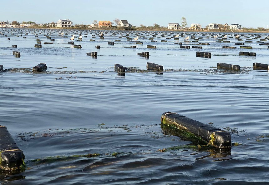
Oysters
Oyster farming is a re-emerging industry that reached its peak in 1922, when farms covered 22 percent of Narragansett Bay. Although oyster farming is a fraction of the size today, they are the state’s largest source of shellfishing revenue. The industry is projected to grow, thanks to strong oversight and management plans from state agencies such as the Coastal Resource Management Council (CRMC) and Department of Health. But warming water impacts spawning, alters the taste of oysters and escalates the likelihood for diseases. Climate change also increase stormwater runoff, which pollutes the bay and leads to shellfish closures.
Even with these threats, however, the report concludes that oyster farming can grow and thrive.
“Rhode Island is well positioned to identify and manage current and future impacts of climate change to the oyster aquaculture industry,” according to the report.
Waterfront homes
The pursuit of waterfront property is coming back to haunt Rhode Islanders. The development of the coast has destroyed marshes and hardened the shoreline with manmade barriers such as seawalls.
Since the 1970s restrictions have slowed building on marshes and construction of artificial barriers. But with 30 percent of the the bay’s shoreline “hardened” by development and rising seas there isn’t much room for nature to adapt or help lessen the force of more powerful storms and erosion wrought by climate change.
Waterfront property owners have to make expensive decisions. Retreat, elevate their homes, or install natural buffers to protect against the inevitable damage expected from the encroaching ocean.
CRMC will initiate the transition to these options with its Shoreline Special Area Management Plan, or Beach SAMP. The guide for coastal property owners about hazards is still being written, but the website offers maps and information about at-risk neighborhoods. Other tools and information about coastal climate risks are available for municipal planners, property owners and the public, such as the recently launched PREP-RI learning site.
The Watershed Counts report warns that shoreline property owners should act soon, as the likelihood of a 100-year storm battering Rhode Island increases. Otherwise, 4,853 coastal homes will be underwater by 2100 thanks to sea-level rise, according to projections.
Watershed Counts is facilitated and paid for by the University of Rhode Island Coastal Institute and the Narragansett Bay Estuary Program, with funding from the Environmental Protection Agency.


Now is the time to move all houses away from the ocean.