Warwick Shoreline Access Tour Proves Particularly Educational
October 6, 2025
Share
WARWICK, R.I. — The sun is beginning to set in the Potowomut neighborhood as 25 people, all that remains of the tour group, reaches one of the last stops of the night, the easternmost public right of way on Charlotte Drive, and runs into an unexpected problem.
Like the other rights of way (ROWs) earlier in the tour, this one leading toward the coastline along Greenwich Bay is a 10-foot wide corridor of green lawn owned by the city for public use. But there’s a problem: the owner of the house next door has installed a sprinkler system the length of the ROW, and it’s going off at full blast when the tour group arrives.
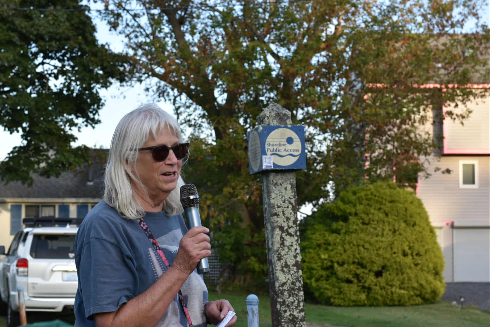
The leaders of the tour — Janet Freedman, a University of Rhode Island Coastal Institute fellow, as well as retired coastal geologist from the Coastal Resources Management Council, and Laura Dwyer, public information coordinator at CRMC — take a moment to explain the corridor is one of the hundreds of state-designated ROWs the coastal agency has catalogued for issues across the state, and take a couple of questions from the crowd.
That catalogue process, said Dwyer, included delivering signage to each coastal municipality in the state. The ROW on Charlotte Drive, like many ROWs throughout the tour, still has no such sign, meaning, in this case, the city’s Public Works Department hasn’t installed it.
A few minutes later, the owner of the home next to the ROW comes out, confused as to why a group of 20 people are dithering in front of his yard. Dwyer engages him, explaining the swath of grass with sprinklers on it is a public right of way.
The owner expresses confusion about the issue, saying the city had OK’d the sprinklers. How can it be public property?
“I am taking care of it,” said the owner, referring to the strip of land that is the public ROW.
The interaction, polite and only 5 minutes in length, was emblematic of the reason CRMC, together with URI’s Coastal Institute and Rhode Island Sea Grant, hosted a tour of the ROWs in Warwick’s Potowomut neighborhood.
Access to the shoreline is enshrined in the state Constitution, but decades of legal precedent preferring fuzzy, badly defined boundaries between public access and private property has led to an uptick in tensions in Rhode Island’s coastal communities in recent years. In part exacerbated by the 2020 COVID-19 pandemic, waterfront property owners have opposed any opening of access to the shoreline, often viewing it as trespassing on private property, or private beaches.
Shoreline access advocates, meanwhile, have argued any enclosure of the shoreline is illegal under the state Constitution, and just a few years ago notched a significant victory when lawmakers passed a new law codifying the public access boundaries to the shoreline.
“We needed to fix what was a boundary but wasn’t actually a boundary,” said Sen. Mark McKenney, D-Warwick, at the beginning of the tour.
McKenney, along with Rep. Terri Cortvriend, D-Portsmouth, were instrumental in passage of the 2023 shoreline access law, which allows legal passage along the shoreline within 10 feet of the lowest seaweed line. Both had served on a study commission in 2022, chaired by Cortvriend, aimed at investigating where the new boundary line for public access should be.
McKenney said he was skeptical when he first joined the commission, but ultimately was convinced by the amount of evidence that a clarified definition of shoreline was needed.
“It gave rise to an awful lot of disputes, and we’re a state that wants to bring in more tourists,” he said. “Undefined public access can have a chilling effect on tourists who don’t want to get yelled at.”
The 2023 law is currently making its way through the state court system. Last year Rhode Island Superior Court Judge Sarah Taft-Carter denied the state’s motion to dismiss a lawsuit filed on behalf of Stilts LLC, owned by David Welch of South Kingstown, who owns waterfront property along the state’s south shore.
McKenney said he expected the case to wind up before the Rhode Island Supreme Court, and that judges will ultimately decide in favor of the shoreline access law.
The law only governs lateral access and makes no changes to perpendicular access to the shore. The public can get on the beach via rights of way, public access points outlined by cities, towns or the state via CRMC, and typically kept in some kind of public trust in perpetuity.
Private homeowners, fire districts, and beach associations frequently try to undermine or restrict public access points when they can. A key point for opponents of the Spring Avenue Extension ROW in Westerly, for example, is that no one ever uses that particular ROW to access Quanachontaug Beach. But supporters of access say that if private property owners obstruct ROWs, no one will use what they can’t access.
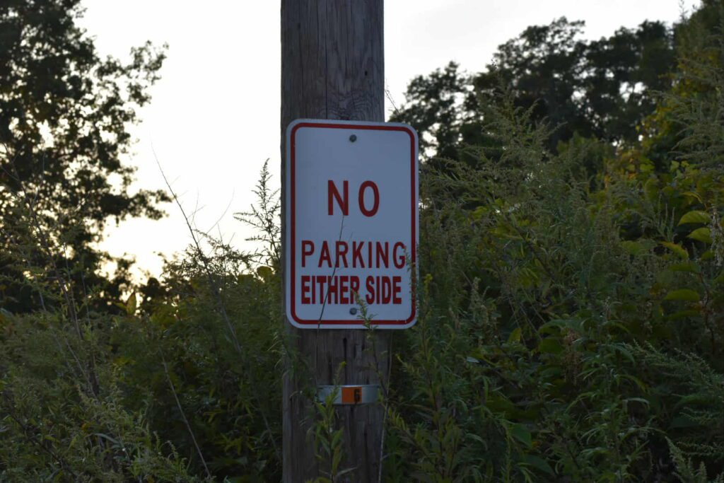
Even before the ROW tour in Warwick began, there was a certain amount of wrangling over parking. The city in recent years has cracked down on illegitimate and illegal “No parking” signs that tend to blanket neighborhoods close to shoreline access points.
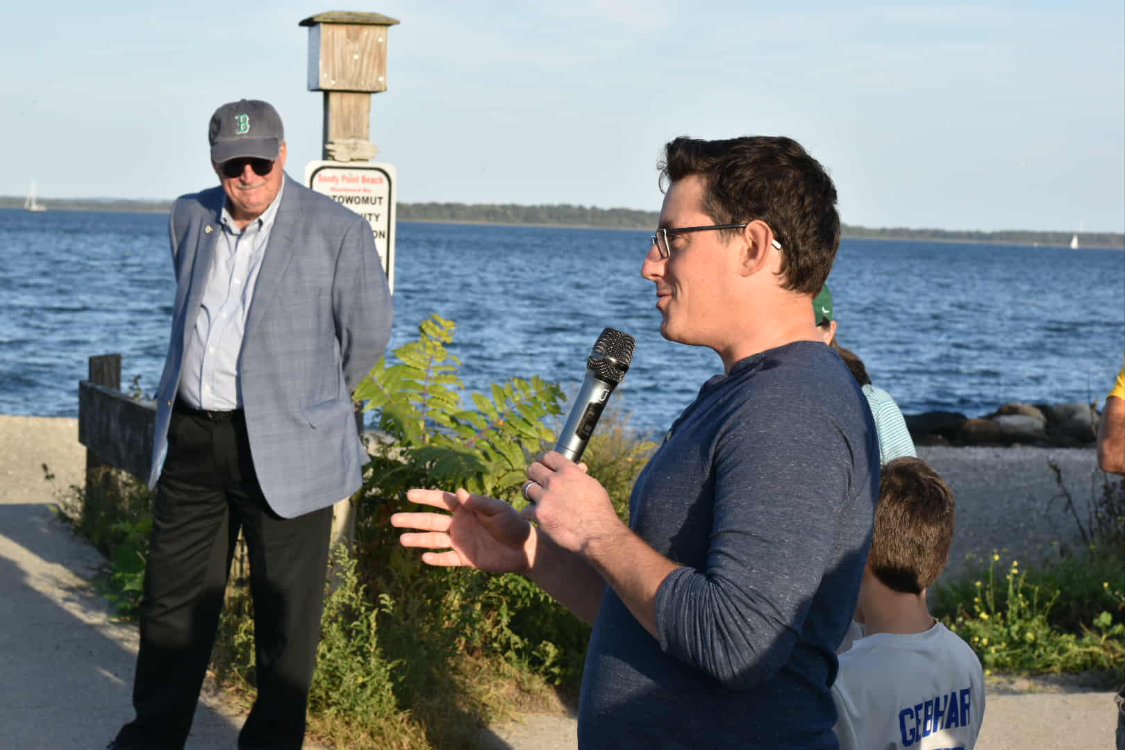
Warwick City Council member Vincent Gebhart, who spoke after McKenney at the start of the tour, said the city’s Police Department had performed a traffic and parking study in the Potowomut neighborhood, identifying all the no parking signs that had no city ordinance behind them or were bought and installed by private homeowners.
Gebhart, who represents the Potowomut neighborhood, said he rode with DPW street by street as they replaced or removed outdated or illegitimate signs throughout the area.
“We want to lead by example for other communities,” Gebhart said. “Fire chiefs are more than capable of determining if streets are safe for passing because of parking.”
The tour was the third shoreline access walk this year hosted by CRMC, Rhode Island Sea Grant, and the University of Rhode Island, each one aimed at educating the public about a different component of shoreline access. CRMC, as the state agency that oversees coastal access issues, has in the years since the 2022 study commission taken a renewed outreach campaign out of state conference rooms and onto the beaches loved by the public.
Previous beach tours in the past have included Westerly, Blue Shutters Beach in Charlestown, and Oakland Beach in Warwick.
Dwyer, whose day job is running communications for CRMC, emphasized to the tour group that her agency didn’t have the means to oversee coastal access issues across the state’s 400-plus miles of coastline.
“If you see something obstructing access, please reach out to us,” Dwyer told the crowd. “We only have two enforcement officers for all the shoreline in Rhode Island; we need everyone’s help.”
The tour began in the parking lot of Sandy Point Beach, a public beach at the easternmost point of the Potowomut peninsula. As the tour spilled onto the beach itself, Freedman pointed to the recently dried seaweed washed up on the sand and noted the public had access rights 10 feet landward of the seaweed, so long as the beach was sandy or rocky. (The new law has no public protections for shoreline access anywhere else.)
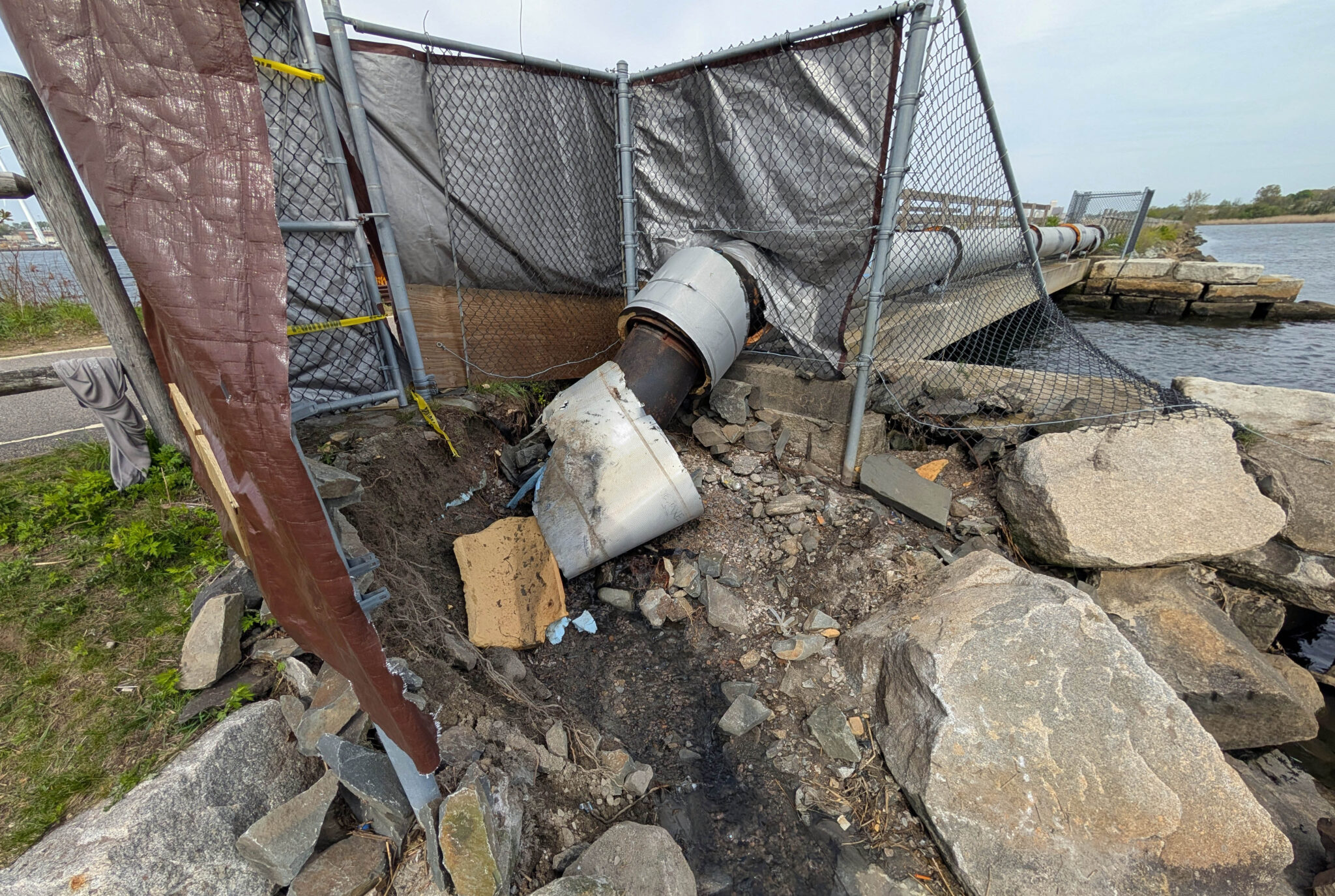
Freedman and Dwyer led the tour north and came upon a wide swale installed by the city that cut a deep furrow across the beach to the water. Dwyer said the swale, which she acknowledged was permitted by CRMC over a decade ago and has long since expired, was to help with stormwater drainage much further inland into Potowomut’s neighborhoods.
Turning back from the swale, the tour headed onto Ives Road before quickly turning and walking down the length of Bradford Avenue. Freedman stopped in front of a marked CRMC ROW, one of the few ROWs visited by the tour that would actually have a sign, before continuing to the end of the road.
The ROW at the end of the road opened up into the ocean, and was likely the only public spot at that end of Potowomut to put a boat in. It even included enough space to park three cars. On the other side of the ROW, noted Freedman, were coastal wetlands, almost all of which were privately owned.
After the Bradford Avenue ROW, the tour headed north toward Charlotte Drive and the ROW that was blocked by active sprinklers. The sprinklers are likely not allowed under state law, but most public access laws in Rhode Island deal with walls, fences, aggressive vegetation, or other means of obstructing the public from access.
The tour visited one more ROW on Charlotte Avenue, before ending in front of the boat launch on Robert Avenue, just as the sun was about to fully set.
CRMC was in the middle of developing a state Public Shoreline Access Management Plan that would have been modeled on the agency’s Special Area management Plan that govern projects along the coast and in state marine waters. The agency, together with Sea Grant and the Narragansett Bay National Estuarine Research Reserve, had received a federal grant from the National Oceanic and Atmospheric Administration for the work.
But NOAA officials pulled the plug on the money in May, writing in a letter to CRMC the grant was not “relevant to the current focus of the Administration’s objectives.” The rescinded grant likely stalls the state’s work toward comprehensive strategy around shoreline access, but agency officials remain adamant about boosting it.
“These walks are a commitment to continue the work, however we can,” Dwyer said.
They need to take walks on Grove Ave Arlington Ave, Park Ave , Payton Ave, Shore Ave and Long Meadow Ave. every time my children try to go to the long meadow beach by using any of these accesses (paper Road) city property . They get yelled at for trespassing . The city should be contacting the owners just because they mow the lawn it’s still city property! Otherwise these owners would be taxed for property and get away with preventing legal public access.
Before his passing many years ago, former Warwick policeman Bob White who lived in Potowomut, pointed out several ROW’s that are currently obstructed by shrubbery. One of these is at the very end of Overlook Drive. Another is located at the end of Wampanoag Road. This ROW is defined by two 3 ft. granite uprights on the right side of the road about 8 ft. apart from each other. The actual path extends to the Green River between two rows of old oak trees. A small stone quay marked the end of the ROW.
Those ROW signs are TINY!
Capron Farm Drive in Warwick, at one time, ended at a beach. A resident, back in the 1980s, manuevered the land over a period of time slowly extending it across the end of the road . This completely blocked access to the beach. It was fought in court and the neighborhood prevailed. It was appealed in a Newport Court and overturned. Large boulders were placed around the controversial land lines. No parking signs garnished both sides of the road.
The owner sold the property to a charitable organization which inturn sold it to a private owner. The property is now enclosed by a wrought iron fence. The only potential public access would be to go through wetlands with 6 foot high vegetation.
The water cannot be reached laterally because both sides of the beach are supposedly private property.
City Hall records were changed to reflect the final outcome. If records before 1986 are available, they would indicate what the original lot dimensions were. There are no records for any purchase of land to support the latest claim.
Sprinklers + vibrant shade of green; fertilizer, too? 🤔
I could not attend the walk in Potowomut but wished I had been able to ask our representatives a few questions.
1. Who is responsible for maintaining the stairs at the ROW? many are gone or so decrepit one would never try to walk down to the water.
2. Once a person does get to the water, how do they traverse the coast as the rip rap walls of major stones prevent any later access to the shore?
3. Parking is a major issue as many residents even put orange cones at the head of ROW keeping residents and visitors wary of accessing the shoreline. What is being done like mandating one side of a street for parking within X hundred of feet from the ROW. If people can not park how do they access the shore. Many roads in Potowomut do have No Parking signs even if legal from Warwick.
So they made them take the sprinklers out right?
So, the sprinklers are on public land and were not installed by the city or the state? Removal is in order. A gulf club should be an adequate removal tool.
Is there a map with all of
The ROWs listed?
Thank YOU!!