Climate Change, Private Interests Erode Public Access to Shore
May 24, 2021
Share
The seed that became a nonprofit ocean advocacy group was planted on a cold January day in 2006, when Dave McLaughlin was told he couldn’t park on a particular road near Salve Regina University and the Cliff Walk.
He and a friend had been surfing at a popular Newport, R.I., spot at the end of Ruggles Avenue. It was a busy day in that section of the city, famous for The Breakers and other Gilded Age monuments, as three events were taking place, including one at Salve Regina University, so the surfers had to park two blocks away on Shepard Avenue.
When they returned to their cars, the surfers were told by university security officers that they weren’t allowed to park on this private way.
McLaughlin said it wasn’t clear then if Shepard Avenue was a public or private street and if, in fact, surfers, Cliff Walk visitors and others couldn’t park there, so the then-35-year-old and his surfing buddy, Frank Hanson, brought the issue of shoreline access to the attention of Newport Police and the City Council.
Fifteen years later, it’s still not clear if Shepard Avenue, while now available for anyone to use without a lecture about parking, is a public or private road. In that time, however, Clean Ocean Access has adopted 31 shoreline access rights of way on Aquidneck Island that it maintains and monitors.
Access was the impetus behind the creation of Clean Ocean Access, but a sewage spill into Easton Bay, the popular surfing spot off Ruggles Avenue, in early summer 2006 and a subsequent spill a month later galvanized local surfers to take action.
Soon thereafter, 27 surfers met to consider what were essentially three options: do nothing; join an existing organization to address the issues; or create their own group and work to solve problems related to public access and water quality.
Clean Ocean Access was created in August 2006. McLaughlin has been the Middletown-based organization’s executive director since 2014, and shoreline access remains a top priority.
At the state level, McLaughlin noted that this effort needs to include increasing the number of Rhode Island Public Transit Authority buses that head to the shore.
Constitutional right
The shoreline is most commonly defined as that part of the coast that is regularly covered by the tide. It’s considered by common law to be public land, held in trust by the state. Each state has different interpretations of what activities the public has a right to pursue along the coast.
In Rhode Island, shoreline access is a right guaranteed by Article I, Section 17 of the Constitution.
The section reads, in part: “The people shall continue to enjoy and freely exercise all the rights of fishery, and the privileges of the shore, to which they have been heretofore entitled under the charter and usages of this state, including but not limited to fishing from the shore, the gathering of seaweed, leaving the shore to swim in the sea and passage along the shore.”
Originally adopted in 1843, the Rhode Island Constitution’s shore access guarantee was built largely around the historic use of ox carts. Farmers, who collected seaweed to fertilize their fields, often used them to carry this material from the shore. The route they followed was typically the highest possible strip of land below the high-water mark at low tide to keep their carts out of the water.
To provide an idea of the shoreline space colonists may have had in mind when the state Constitution was written, McLaughlin noted that the typical width of an ox cart was 10 feet. He also said it’s believed coastal space was guaranteed so Roger Williams could render right whales.
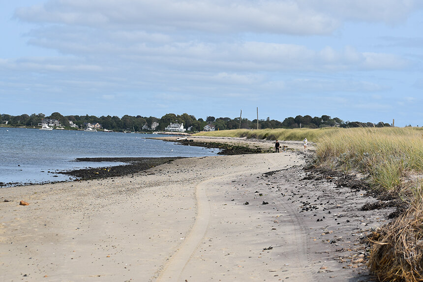
Rhode Island’s public waters extend from mean high water to 3 miles out to sea. The land above mean high water is often privately owned. Of course, sea-level rise and erosion are changing mean high water and complicating a controversial situation.
A 1982 Rhode Island Supreme Court case tried to bring some clarity, defining mean high water as the average of high tides over an 18.6-year cycle.
Coastal conflicts
Clean Ocean Access and Save The Bay aren’t the only organizations working to ensure public access to the Ocean State’s marine waters. When the Coastal Resources Management Council (CRMC) was formed 50 years ago, part of its mission, as required by the Coastal Zone Management Act of 1972, was to secure “increased opportunities for public access, taking into account current and future public access needs, to coastal areas of recreational, historical, aesthetic, ecological, or cultural value.”
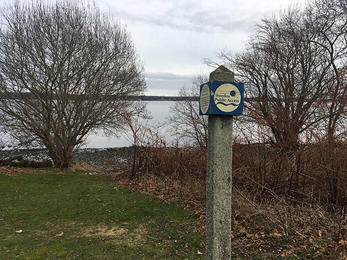
During the past seven years, CRMC has mapped 222 rights of way. The Rhode Island Geographic Information System website also keeps track of the state’s shoreline rights of way. The 222 public access points are those that have been CRMC certified, according to McLaughlin. He said there are many other rights of way that still need to be officially delineated. He pointed to the west side of Aquidneck Island, where there is a lot of Navy-owned property, as one area that lacks a significant number of public access points.
The General Assembly has set a goal of identifying at least one right of way for each mile of Rhode Island shoreline, with a goal of 420 access points.
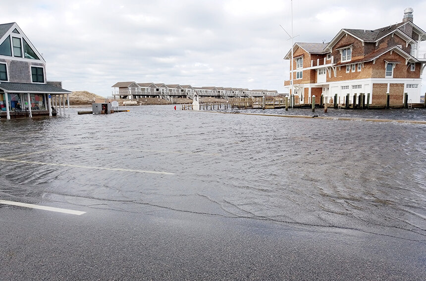
Rhode Island’s waterfront property is some of the most valuable and desirable in the state. The rising cost of flood insurance is putting ownership into the hands of fewer and fewer.
The Ocean State’s shoreline is also an area ripe for conflict, with many private property owners believing, incorrectly, that their property extends all the way to where ocean waves crash and the public often trespassing on private land.
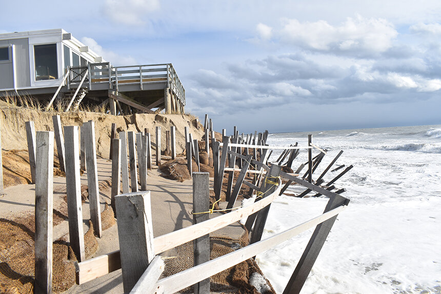
These situations can result in the illegal hardening and obstructing of the shoreline and lengthy disputes that end up in court. Private property owners decide to build structures, such as fences and seawalls, on state land to keep out the public and/or to protect their property from the encroaching sea. These structures can restrict shoreline access for extended periods of time as the disputes make their way through municipal and state government.
McLaughlin recalled one such situation that lasted from April 2016 to May 2017. He said he was amazed it took 13 months to resolve.
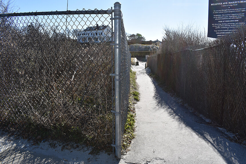
A property owner along Bailey’s Beach, at the end of Bellevue Avenue in Newport, had erected a chain-link fence about a foot into a right of way. Since the fence was 180 feet long, McLaughlin noted that the structure impacted about 40 percent of a public path to the shore. To rectify the situation, he worked with the city and the property owner, who eventually had the fence moved back onto his own property.
Accessed denied
In an attempt to better protect the public’s Constitutional rights, lawmakers last year introduced a bill that would have prevented the criminal prosecution of anyone who attempts to exercise their shoreline rights within 10 feet of the most recent high-tide line.
Narragansett resident Jim Bedell has been studying and following the issue of shoreline access for the past 20 years. He even created a website to keep tabs on developments.
The retired high school geology and physics teacher noted that going back to the days of the Romans, and into early Colonial days, it was recognized that access to the sea was crucial for a society living along the coast. He said people’s lives were linked to the ability to use the dry land along the edge of the water. It wasn’t an ownership issue, he said.
During a tour of South Kingstown with Bedell last November, he showed ecoRI News two examples of beachfront property owners obstructing shoreline access. One of the locations is at Moonstone Beach, where, at high tide, passage is tricky at best, and the other is at the Deep Hole Fishing Area at the end of Matunuck Beach Road (highlighted in video above).
Like the structures along Rhode Island’s built-up coastline, climate-crisis impacts are putting the Ocean State’s collection of shoreline rights of way at risk. McLaughlin said sea-level rise, of just 1-3 feet, combined with more intense and frequent storms will wash away some rights of way, restrict access to others and damage recreational infrastructure, such as boat ramps, beach pavilions and the Cliff Walk.
The cumulative effect will impact the state’s renowned tourism sector.
Regardless if you are lucky enough to own beachfront property or have the ability to access rights of way, McLaughlin believes stewardship of Rhode Island’s coastline is your duty.
“Those who enjoy the things that make Rhode Island the Ocean State that comes with extra responsibility,” he said. “People who most frequently use the coast should be the most responsible for it.”