Urban Cores are Already Feeling the Heat
Metropolitan areas most susceptible to multiple climate threats.
January 18, 2016
Is southern New England adequately prepared for the impacts of the projected harsh weather ahead, especially on its most vulnerable residents: the sick, elderly, young and poor?
ecoRI News looked at Providence and Central Falls, R.I., and three cities in southeastern Massachusetts to check on their readiness for climate change. For the most part, all are making and improving their plans to help underserved groups. Emergency-management agencies across the region are on guard for floods, heat waves, cold snaps and power outages.
Providence
Severe weather poses a heightened threat to Rhode Island, as 90 percent of its population lives in urban settings — the areas most susceptible to multiple climate threats. Much of the rest of the state lives in coastal areas, which come with another set of risks heightened by sea-level rise and flooding.
Providence has both urban and coastal problems related to climate change. A NASA study of 42 cities in the Northeast found that Providence has one of the highest heat-island temperature disparities. As a densely built metropolis, Providence is more than 12 degrees warmer in summer than the surrounding geography.
It also has an extremely diverse population: 29 percent are foreign-born and 26 percent live below the poverty level. Fortunately, it has a progressive and innovative plan to protect its diverse population. After hiring its first sustainability director in 2011, the city began looking beyond the traditional emergency response-planning practices of establishing shelters and evacuation procedures.
The city first identified the health impacts of climate change in a 2012 report. It singled out at-risk groups and launched a comprehensive sustainability plan, which seeks to address water and food availability, infrastructure durability, air and water pollution, health issues, and communication.
So far, the program has launched initiatives to reduce flooding through green infrastructure and streetscapes, and advanced the development of a multi-city stormwater management system. The city also launched a CodeRed information campaign that provides emergency alerts in English and Spanish.
Additional partnerships with Brown University are also moving forward. A pilot plan on the West Side replaces paved and cement surfaces with water-absorbing vegetation. A project with the Environmental Justice League of Rhode Island and other groups is creating “health equity zones” around the city’s nine recreation centers. These public spaces are expected to reduce the effects of heat and flooding and provide safety and healthier landscaped common areas.
An ongoing tree-planting campaign focuses on mapping urban hot spots and reducing the heat-island effect in low-income neighborhoods. The program recently planted its 10,000th tree. Other initiatives focus on youth education, community-response teams, painting roofs white and planting green roofs to reduce heat. All of the programs will or are being delivered through a multilingual communications and outreach initiative.
In February, the city will unveil a design-resiliency program to identify and remodel infrastructure in the most at-risk neighborhoods.
“This is certainly an area that is priority of the mayor’s,” said Leah Bamberger, the city’s director of sustainability. “We’re keenly focused on Providence as a coastal community and there is certainly a need for this.”
Social-justice issues are particularly prominent in South Providence, where the predominately low-income neighborhood is exposed to a mix of pollutants from its industrial port and traffic emissions along Interstate 95.
Flooding and severe weather threaten to release toxins from an oil terminal, an asphalt plant, and chemical mixing and storage facilities at the port. A proposed liquefied natural gas plant has drawn protests from neighborhood groups about harmful emissions. Flooding threatens to release toxins buried in brownfields scattered throughout the neighborhood.
Monitoring is underway to measure air quality around the port and highway. The results will address long-held suspicions that air pollution and higher temperatures, and the ensuing ozone-alert days, are triggering asthma attacks and causing respiratory diseases and other ailments.
Low-income residents are protected from utility shut-offs during the winter but not in the summer, when there is an increasing reliance on air conditioning.
Julian Rodriguez-Drix, an Environmental Justice League of Rhode Island board member, said the first priority is to improve communication. “There’s such linguistic diversity in both Providence and Central Falls … that people may not get the alerts,” he said.
Central Falls, R.I.
This Providence County city is also curbing emissions, advancing sustainability and preparing for a world altered by climate change. Under the direction of Mayor James Diossa, the city of 19,000 living in just 1.3 square miles is merging its emergency-management agency with neighboring Pawtucket. This partnership expects to put greater emphasis on addressing extreme weather events.
The city, which has the highest percent of Spanish-speaking residents in Rhode Island, aims to curb carbon emissions by promoting intermodal transportation. One of its priority projects is the proposed Central Falls-Pawtucket train station. The city also is boosting its bike culture by installing bicycle-repair stations, and has recently been awarded grants to paint a bike lane through the city.
Central Falls also is pushing alternatives to car ownership, with the implementation last year of car-ride services Zipcar and Uber.
This year, the city is expected to launch a program that would allow low-income residents to finance home repairs and upgrades, which they might otherwise not be able to afford. These repairs would allow residents to incorporate energy-efficient materials and products into existing structures, leading to energy cost savings.
Brown University environmental studies professor J. Timmons Roberts has introduced several of the projects to address climate-change adaptation in Providence and Central Falls. He worries that the planning, so far, isn’t adequate.
“These are two cities that are starting the process of identifying at-risk populations and developing plans to reach them in the case of an emergency,” he said. “However, we are very far from having adequate systems to identify, warn, reach out to, and help all the vulnerable people in our cities.”
Heat waves in Chicago, Paris and Moscow, he explained, saw thousands of isolated elderly people die locked in their apartments. “Their fear of crime and social isolation combined with failing health put them at far higher risk than other groups,” Roberts said. “I think we can do much more to plan for reaching and helping these people, but at least we are starting.”

Southeastern Massachusetts
While Rhode Island is making efforts to protect specific at-risk groups, Massachusetts doesn’t explicitly address its most vulnerable populations from climate-change impacts. Instead, it takes a broader approach to emergency preparedness. Each city employs full-time emergency-management personnel who are constantly trained to address the extreme weather the region has endured in recent years.
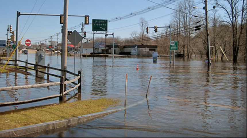
Taunton, like much of southeastern Massachusetts, is built among vast stretches of hardwood swamps. Dams dot the region, and tributaries of the Taunton River are prone to flooding.
With the floods of 2010 fresh in his memory, Richard Ferreira, Taunton’s emergency management director, frequently updates plans to manage water risks and keep people out of harm’s way. Emergency shelters are opened regularly to accommodate residents suffering from extreme heat, cold and power outages.
“The planning is going on all of the time,” Ferreira said.
Communication with the local National Weather Service office is vital, he noted. Weather alerts and emergency communications are broadcast across multi-languages radio and TV channels. Seniors are identified and assessed for sheltering in-place or evacuation through the local Council on Aging.
Planning is also done for residents with access and mobility issues with the Office of Homeland Security, local housing authorities and fire departments.
“As many resources that are out there,” Ferreira said, “it’s incumbent upon every community to be prepared because they are all so different.”
Fall River’s steep hills and low-lying western shore present geographic challenges.
“We’ve got significant events you have to be prepared for,” said Richard Aguiar, the city’s director of emergency management for 16 years.
Climate change, he noted, is another piece of emergency preparedness, which mostly requires a careful monitoring of the weather.
Similar preparedness programs operate in New Bedford. Ferreira and Aguiar meet and collaborate with emergency-management directors across the region to address storm planning, most recently to prepare for tornadoes.
“Weather is a huge issue for us on a daily basis,” Aguiar said.
As a peninsula cooled by surrounding Buzzards Bay, New Bedford doesn’t consider rising heat a problem. Fortunately, federal funds paid for the construction of a hurricane barrier in 1966. The city installed pumps to protect its low-lying coastal neighborhoods from flooding.
The historic whaling city is winning points for climate-change mitigation. It is nationally recognized for having the largest municipal solar-energy program in the country, and has the largest municipal electric-vehicle fleet in Massachusetts.
“New Bedford has made climate change a priority and so the city is doing its part to address the problem and set an example for other communities,” said Elizabeth Treadup, a city spokeswoman.


Seems to me the most basic weakness of our area is that we have a high population that grows only about 2% or so of our food. If there are massive droughts, floods, or violent disruptions in major food producing areas we could be at risk, at least of price spikes. Best to plan on producing a lot more of our food, stop squandering farmland for development and parking (and casinos?), stop polluting productive estuaries, promote conservation of water….