Popular East Bay Bike Path Makes Community and Work Connections
September 11, 2023
Share

PROVIDENCE — It’s not rain, snow, or cold that keeps Tiffany Rhodes from riding her bicycle some 10 miles to work. It’s the late-afternoon darkness in January, February, and much of March that forces her off the East Bay Bike Path and into her 2017 Jeep Renegade.
Rhodes, who has been an active mountain biker for much of her life, works full-time at Johnson & Wales University. The associate professor in the Center for International Travel and Tourism Studies teaches environmental and sustainability classes at the university’s Downcity and Haborside campuses.
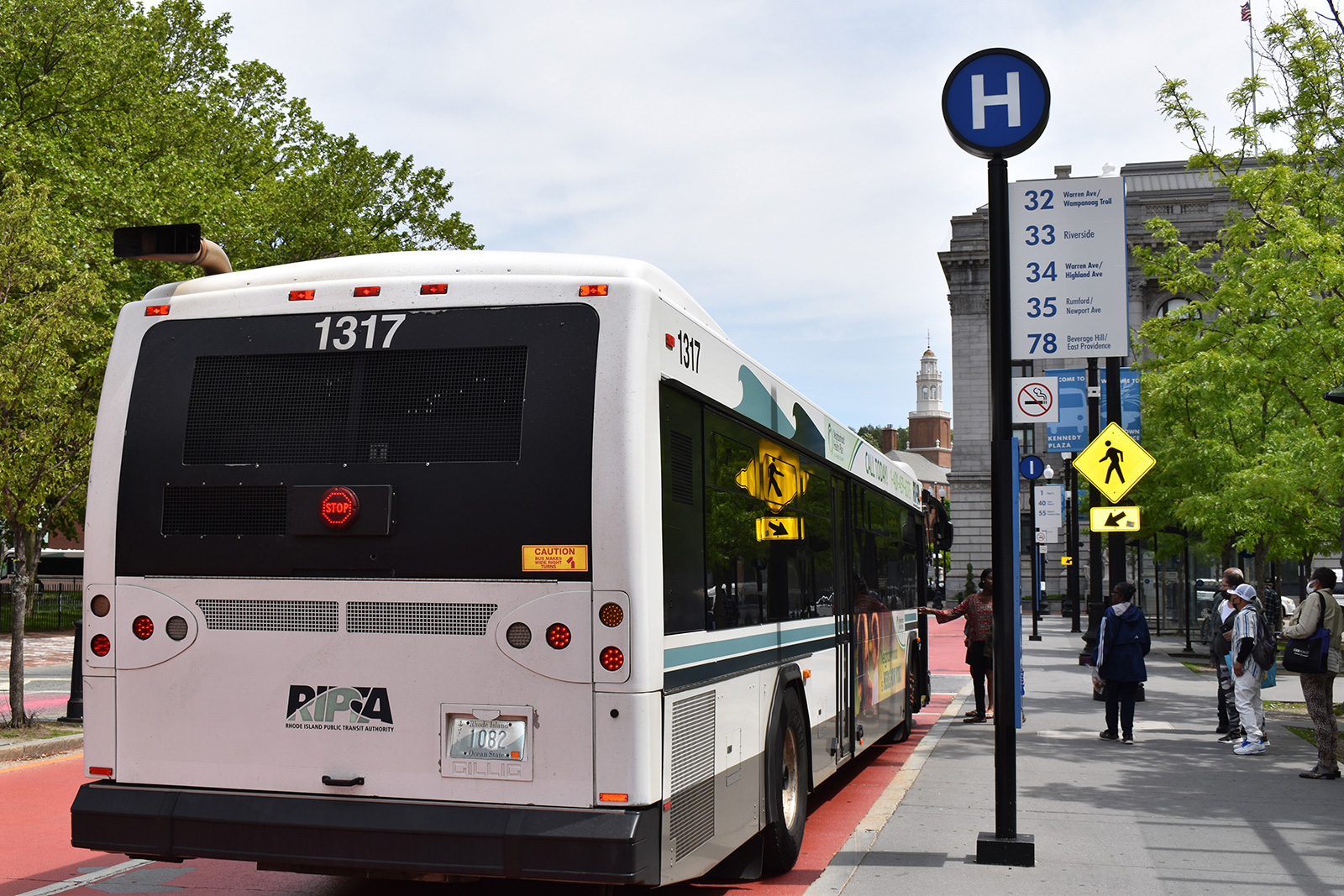
The Pennsylvania native who moved to Rhode Island 10 years ago has been commuting to work via the popular East Bay Bike Path for the past five years. The Barrington resident would have started earlier, but thought the bike path ended in East Providence. When she finally found her way through that tricky section of East Providence that leads to the Washington Bridge, which connects Watchemoket Square to India Point Park across the river, her commute became more relaxing and much less polluting.
“When you’re on the East Bay Bike Path, it stops right at the bottom of Veterans [Memorial] Parkway and then there’s like that weird alley road sort of thing,” she said during a recent interview outside a restaurant on Westminster Street, her first e-bike locked up a long three-pointer away. “I thought that’s where it stopped, and I was afraid to ride on the streets. But then I discovered that you only have to ride that little section and then the bike path picks up and goes across [Interstate] 195 all the way to India Point Park. And that’s when I realized, ‘Oh my gosh, like I can bike to work pretty protected like the majority of the way.’”
Rhodes noted her commute is “98% protected bike space,” including some safeguarded lanes installed by the city.
“I feel so grateful that I have protected bike space, and it’s a shame that not everybody has that,” she said.
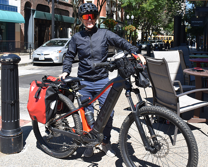
Her Barrington home is about a mile away from the bike path, so her ride to work begins on a tree-lined residential street and then switches to another tree-lined swath of asphalt. Depending on which of her eight bicycles she chooses and which campus she’s headed to, her commute can take anywhere from 30-45 minutes each way.
It’s typically the best part of her day. Only a lack of light keeps her from enjoying it more often.
“What I found with bike commuting is that not only did I not get gas — I didn’t fill up my gas tank that entire fall term when I first started commuting — but also it was amazing,” Rhodes said. “It slows our lives that are so hectic … we all complain that our lives are so busy, and we’re just racing here and there … this is one instance in my life where I could slow it down.”
The East Bay Bike Path is one of the crown jewels of Rhode Island’s bicycle infrastructure. It stretches from the city of Providence to the town of Bristol, tracing the Providence River south as it broadens into upper Narragansett Bay. The mostly flat asphalt path traverses five municipalities, wetlands, and wooded areas, often with clear water views, making it popular with bicyclists, joggers, walkers, hand-holding couples, bold wildlife, and commuters like Rhodes and the others she sees peddling their way to work.
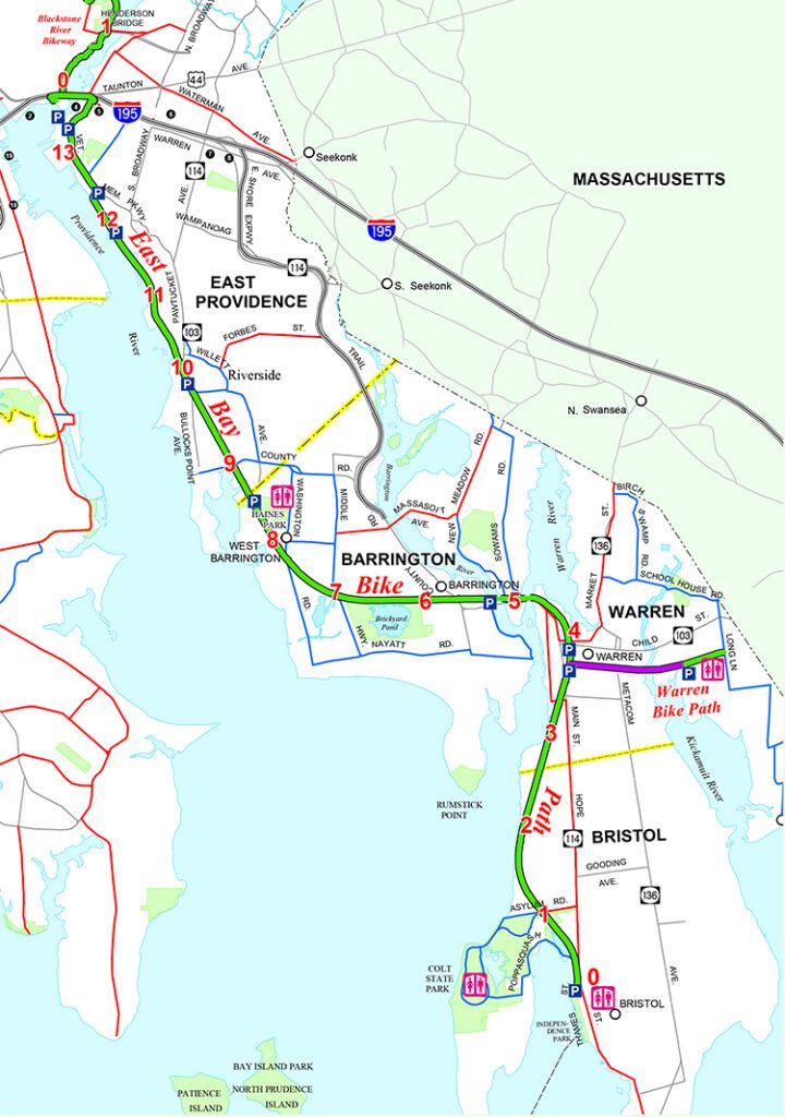
It extends 14.5 miles from India Point Park to Independence Park, passing through several other state and local parks and recreation areas, including Bold Point Park and Squantum Woods in East Providence, Haines Memorial State Park and Veterans Memorial Park in Barrington, Burr’s Hill Park in Warren, and Colt State Park in Bristol.
“With spectacular maritime views and an abundance of coastal wildlife, the East Bay Bike Path offers a spectacular New England experience,” according to the Rails-to-Trails Conservancy website. The path was Inducted into the Rail-Trail Hall of Fame in 2009.
Plenty of reviews on the Rails-to-Trails Conservancy website sing the praises of the multiuse path. A sampling:
“Beautiful ride amazing views made me love RI again.”
“This is my favorite bike path for scenic water views! … Bring cash to buy an iced Lemon drink at Dels.”
“Rode the length and back at height of peak season at peak time of day, a Saturday evening, while trail was crowded, everyone was cooperating with rules of the road and apparently having a nice experience. This is my husband’s favorite trail, as he says, great trail, paved, scenery and an ice cream at the end, what more could you want?”
“Love everything about this bike path.”
The 10-foot-wide path connects neighborhoods and business districts. The entire path follows a route taken by trains starting in the 1850s. The rising popularity of automobiles, however, put an end to passenger service in 1937. Freight service continued until the mid-1970s. Some fragments of railroad track remain.
The out-of-service tracks could have remained as a memorial to the region’s transit and industrial past, but Bristol state Rep. Thomas Byrnes Jr., with support from Matthew Smith, the Rhode Island speaker of the House, proposed transforming the railroad into the state’s first big bike path.
In March 1980, a few years after the oil and gasoline shortage caused panic, Byrnes filed a bill that called for a study of bicycling as an alternative form of transportation and as an energy saver. The idea of the East Bay Bike Path was born.
The longtime popularity of the path gives a false impression it was a beloved idea from the beginning. It wasn’t. The lawmakers’ plan faced ferocious opposition from people who prioritized road maintenance over bicycle infrastructure and ignorant residents who claimed there would be an increase in crime, brought to their communities from urban dwellers in Providence and East Providence.
When the 50 or so people gathered on a walk organized to give them an idea about what the bike path could look like, they were met by the manager of the Squantum Association in East Providence who had German shepherds and cars designed to prevent the group from passing anywhere near the waterfront property.
A member of the East Providence club who was friends with President Reagan’s chief of staff, James A. Baker III, wrote him a letter begging the federal government to withhold money for the project.
Transit advocates, such as Byrnes, Smith, Robert Weygand, Ed Wood, and George Redman refused to be intimidated and the proposal eventually prevailed. Redman’s name and portrait is featured on the section of the bike path that crosses I-195’s Washington Bridge.
On May 22, 1986, ground was broken at Riverside Square. Construction took place from 1987-92. In 1992, the East Bay Bike Path opened.
For the past three decades, this Rhode Island biking jewel has helped reduce the state’s carbon footprint, lessened traffic congestion, and provided some much needed physical activity and mental health therapy for many.
Note: The Trek Powerfly recently bought by Tiffany Rhodes is a Class 1 e-bike with pedal-assist, which means the engine only helps propel the rider while pedaling, and the function stops when the bicycle reaches a maximum speed of 20 mph.
This story is part of our “Special Places” series. Read other stories in this series.
A gem indeed. I can’t wait for that late winter day when it’s warm enough to take my first ride of the year on the East Bay.
But we are sadly neglecting our other great bike path, the one with frankly greater potential than the E.B. as a future transportation artery as well as being a gorgeous, if aesthetically different, pleasure ride: the East’s Bay’s much longer “West Bay” cousin, the awkwardly named “Washington Secondary Bike Path.” It takes you from Rt 10 in Cranston to Interstate 395 in Connecticut and beyond.
Try it some day. You’ll notice two things right away. The pavement is wider and therefore safer than the East Bay’s. Then travel a hundred yards and you’ll notice how badly neglected that pavement really is through the Cranston and Warwick sections. The lush canopy overhead is a plus on hot days, but root damage your tires encounter is far worse than it ever was on the East Bay. It’s like riding on asphalt corduroy in places. You’ll have to travel fairly slowly until you cross into West Warwick. Doesn’t look like any of that section has ever been re-paved since inception. But you’ll notice immediately, too, how this section of the path could—and should—function as trunk route for commuters in this densely populated corridor were the concept taken seriously by planners and funded adequately by the State and Federal governments. In this regard, the path has much more potential than the East Bay.
The bad pavement does disappear, mostly, when you get to West Warwick and you are following the Pawtuxet River. The ride from there, and on through Coventry past Tiogue Lake to the hamlet of Summit, just past Rt 102, is beautiful, historically compelling, and freer of bumps than the East Bay. If the tourist wishes to understand Rhode Island’s socio-industrial history, this is ride to take. You traverse mill village after mill village, their historical fabric still largely intact. Little text is needed to explain and appreciate what you are seeing. You understand it from the perspective of your bike on the path and the river it follows. You’ll also wonder to come back and launch your kayak or canoe and take in that beautiful perspective that way as well—yes, the perspective that “other river” too long in the shade of our ballyhooed Blackstone .
Next, Coventry has done an exceptional job of maintaining its long segment of the path. You leave the river and head west, first past beautiful Tiogue Lake and environs, and then you are in forest headed for the hamlet and former railroad stop of Summit, a half mile beyond Rt 102 deep in the wilds of western RI. There you must detour to Rt 117 for a two mile-or-so segment that is not marked for bike traffic and is sadly in need of re-pavement and shoulder widening—though there’s very little traffic. And you are brought to the hamlet of Greene, and there pick up the old railroad bed once again for the crossing into the Connecticut woods and then the old mill villages of Sterling and Moosup and beyond.
This entire “West Bay Bike Path” deserves much more attention.
Frank, Scott H and Grace K also got this a little mixed up in the past when it comes to the history. Matthew Smith was the speaker of the House when the Bike Path bill was introduced by my father Thomas H. Byrnes Jr. Smith offered encouragement, but the other two men who really made this happen in the early days were the late Gov. Garrahy and the late Ed Wood. Neither has received much credit, esp. Ed Wood who had served in both DOT and DEM and took much of the abuse in dealing with the opposition from many powerful people in the State. Ed Wood was the one who laid out the plans for the RI bike path system, emphasizing linking state parks and providing access to the shore.
The fight was actually waged in the RI press, journalism at it’s best!
For the record, this is what was said about the early days of the bike paths by the late Ed Wood:
“It was one of the toughest things I ever did in state government, because of really deep seated opposition from many politically connected people. I think (Tom Byrnes) and I drove Governor Garrahy crazy and many times he wished the whole thing would just go away, but he never told us to stop working on it and eventually we persevered.
In later years I became quite close to Governor Garrahy and we often reminisced about it. He always said that there were few projects which gave him more headaches while he was in office, but that after it was done he got more positive comments about it than any other thing that he had ever done except for the (1978) blizzard. A major share of thanks for its success should go to Joe Arruda, long time chief of planning for RIDOT… He quietly kept things alive through several DOT directors who could care less about it, until I came along and gave him lots of support”.
Judith, thank you for your comments. My bad on forgetting the many contributions of Mr. Wood to the creation of the East Bay Bike Path. Grace wrote a nice story about Ed upon his passing in 2020 (link provided). I added his name to the story. https://ecori.org/2020-10-28-the-exceptional-life-of-environmental-pioneer-ed-wood/ — Frank Carini, ecoRI News
We love the trail, but disappointed that the detours over the closed bridges (over the Barrington and Palmer Rivers) have not been repaired yet. Any timeline for repairs?