A Path Forward for Bicycle Infrastructure on Aquidneck Island
February 15, 2024
Share
Want to bike from Portsmouth, R.I., to Newport? You’d best steel your nerves and notify your next of kin. The most direct route will take you down a high-speed four-lane road with a scant to non-existent shoulder.
This reporter has done it.
Once.
Even a short bike trip within Portsmouth or Middletown remains an activity for only the most seasoned cyclists, as neither town has bicycle infrastructure, and, in some cases, lacks even sidewalks along main roads.
With 80% of all car trips on Aquidneck Island amounting to 5 miles or less, transit advocates have long viewed Aquidneck Island, which is just 5 miles wide and 15 miles long, as a prime candidate for improved bike transit.
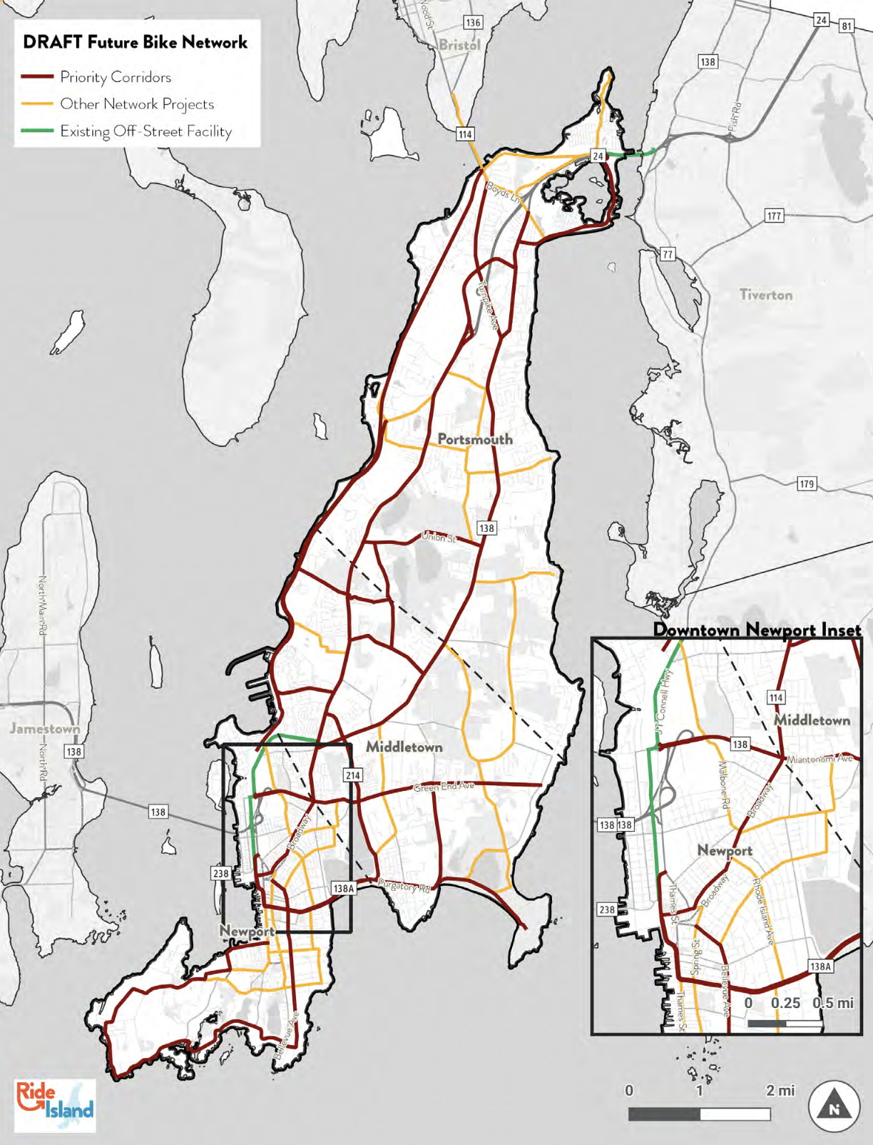
That potential is the impetus behind Ride Island, an-island-wide bicycle initiative led by Bike Newport and Grow Smart Rhode Island, which aims to create a connected bicycle network to encourage bike transit on Aquidneck Island.
“The broader context for this [plan] is creating and funding a connected bicycle network to make it possible for people who want to bike and walk to get where they need to go, which in large part is short distances,” said Bari Freeman, executive director and founder of Bike Newport. “That requires safe, separated infrastructure for people to comfortably choose those modes.”
According to a survey conducted for Ride Island, 60% of those living on Aquidneck Island want to bike but opt not to take a two-wheeled trip because they’re concerned about safety.
In a wide-ranging conversation with ecoRI News in the fall, Freeman touched on some of the past challenges to establishing a bike network.
“We just keep doing things the default way and then throwing down white lines and calling it a bike lane. Bike lanes or any symbols about bikes are going to make the people who were going to be there already feel a little bit more visible … but it doesn’t get any new people out biking, and it doesn’t protect the people who are there. The only thing that’s going to do those two things is separation.”
Separation of bikes from cars, that is.
Eighty percent of all car trips on Aquidneck Island today are just four miles or less; more than half are two miles or less.
Over the years, there have been multiple plans and studies related to creating bicycle infrastructure on Aquidneck Island, including a 2015 bicycle design study of a Portsmouth segment of a proposed island-wide bike network, which considered three bikeway alternatives and their impacts, estimated constructions costs, and anticipated permitting actions.
In 2013, ecoRI News reported on plans for an 18-mile Aquidneck Island Bikeway, which was to run from Easton’s Beach, along the western edge of Aquidneck Island, to the Sakonnet Bridge bike lane in Portsmouth.
At the time, the project was hailed as a collaboration between local, state, and federal agencies. The Aquidneck Island Planning Commission was charged with overseeing the project with input from a previous design study.
And that original concept was conceived through a multimodel transportation study completed in 2011. It all adds up to a layer-cake of plans that have gone nowhere.
That brings us to today and Ride Island.
Freeman is optimistic this latest plan has a better chance of moving forward because it builds upon those past studies, addresses gaps in the previous work, incorporates additional transportation data, and bolsters the planning process with engagement of traditionally underrepresented stakeholders and a coalition of advisory committee members.
Ride Island is “taking it to the next level,” Freeman said. “It’s getting those plans off the shelf and figuring out how to link them together and optimize the outcomes. It involves so much collaboration, getting the municipalities to know what each is doing. And, we’re at a moment when there’s a lot of funding available, and we have to ask for it.”
Along the lines of funding, Ride Island seeks to piggyback on the State Transportation Improvement Program (STIP), a list of transportation road-paving and capital improvement projects Rhode Island intends to implement using U.S. Department of Transportation money.
In fact, looking at projects that align with STIP plans was the first step in identifying Ride Island’s priority projects on Purgatory Road and Aquidneck Avenue in Middletown and East Main Road in Portsmouth and Middletown.
North to South, and East to West
According to Ride Island, East Main Road has the greatest promise for ferrying bicyclists from north to south on Aquidneck Island.
“There is great potential for converting short auto trips to bike trips, but this corridor has among the most hostile conditions for biking,” according to the report.
Moreover, because this road is maintained by the Rhode Island Department of Transportation (RIDOT), any improvements, even those approved and desired by municipalities, would ultimately need RIDOT’s final blessing and support.
The plan recommends:
Testing a reconfiguration of East Main Road as part of the upcoming RIDOT resurfacing project (scheduled for this spring). The plan calls for “reconfigured pavement markings [that] can be applied to the base course of pavement, and observations and adjustments [that] can be made before the final pavement surface is applied.”
Advancing two short segments of East Main Road for early implementation: between Turner Road and Oliphant Lane in Middletown and between Sandy Point Road and Union Street in Portsmouth.
Reconfiguring East Main Road to prioritize safety for pedestrians and bicyclers above the convenience of commuters, as traffic congestion, which the plan says “can be tolerated for short periods of the day as a tradeoff for safety and livability benefits.”
Another north-south option identified by Ride Island is the active rail corridor that runs along the west side of Aquidneck Island. The rail, currently used by the Grand Bellevue Dinner Train and Rail Explorers, has the potential to serve as a major car-free connection, with a portion of the corridor near the Newport Gateway center already complete.
This rail project, which, at 10.6 miles, could have the biggest payoff in terms of an off-road island-long connector, also faces the biggest hurdles, as it would require buy-in from all three Aquidneck Island municipalities, the Navy (the rail runs through naval property), RIDOT, and operators of tourist uses of the railroad corridor. It would also require significant capital funding.
Ride Island also proposes routes for several cross-island connectors to help bikers safely navigate from the east side to the west side of the island. Routes include:
A cross-town connector between Newport’s North End with Green End Avenue.
A Middletown connector on Oliphant Lane to connect East and West Main roads.
A mid-island connector on Union Street in Portsmouth to connect East and West Main roads.
These connectors, at the least, could include traffic calming measures, with some potentially hosting separated lanes in the future as permission and funding allows.
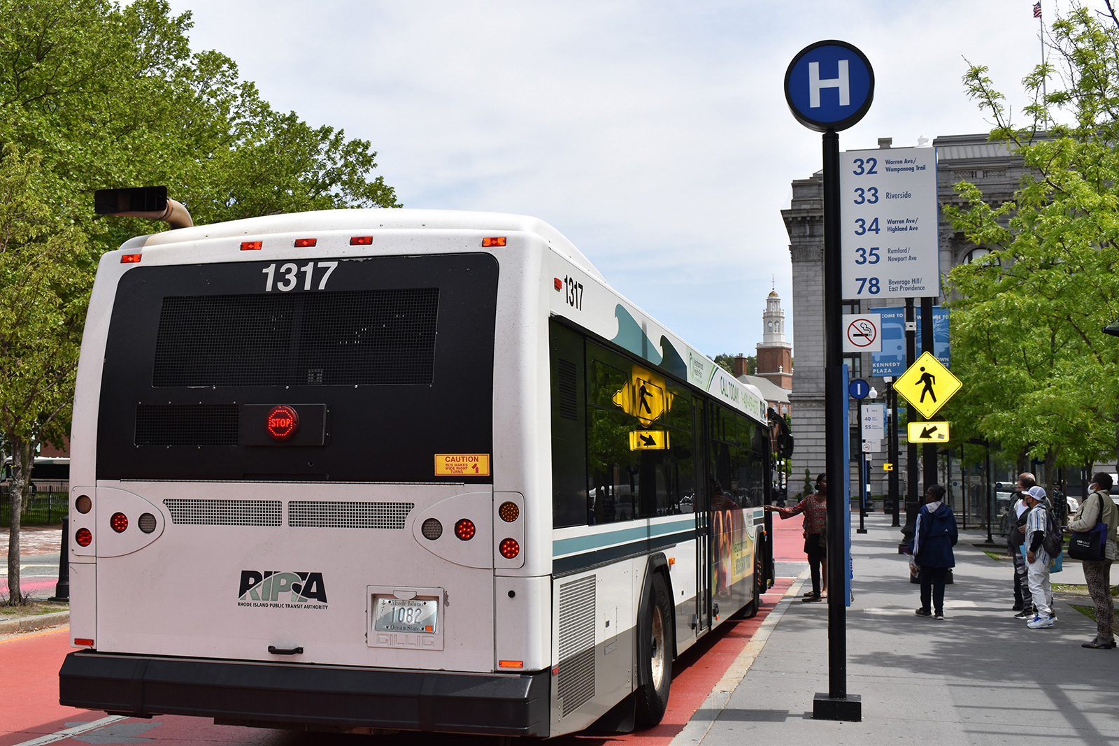
The biggest question mark hanging over many of these proposed routes is RIDOT, which has jurisdiction over many of the roads identified as potential bicycle routes by Ride Island. The agency has often raised the ire of transit advocates with its car-centered approach to transit. In 2021, RIDOT asked the city of Providence to stop work on a bike lane project on South Water Street, and it has long withheld crash data — data which could be used to improve road safety for cyclists and pedestrians — from transit advocates and the public.
Cycling forward
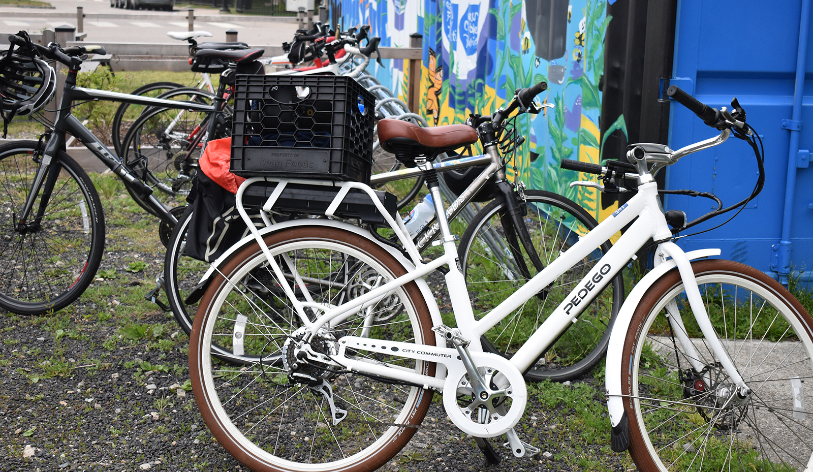
Some progress in bicycle infrastructure can be seen on Coddington Highway in Newport, where the road was reduced from four traffic lanes to three to accommodate a shared-use path for bikes and pedestrians. It was developed with help from Bike Newport.
But in the northern part of the island, Portsmouth Town Council member Daniela Abbott noted, “There is a lot of planning fatigue. And there’s not much to show for it. I do think we’re at a point where people are tired of planning. … We just need to kind of pick, even if we start with the low-hanging fruit, as long as we’re working towards the ultimate end goal of having cohesive corridors up and down open an island, then we’re going in the right direction.”
For Abbott, who moved to Portsmouth from New York City 13 years ago, her “aha moment” happened when she was home with her daughter on maternity leave. “I wanted to go for a walk with a stroller and there’s nowhere safe to walk,” she said, noting that her Portsmouth neighborhood off Middle Road has no sidewalks.
“The fact that we can’t get on a bike to go down to the beach comfortably and safely is really kind of a shame. … Prioritizing pedestrian access and bike access across the island would be a huge improvement in the quality of life for the people that live [here]. And it would also be an asset that would add value for the tourism industry,” she said.
When it comes time to support funding a grant application for any of these projects, she encourages residents to send a quick email of support to the Portsmouth Town Council.
“We’re primed to start getting some funding going. I would like to see the town invest more in these kinds of projects,” said Abbott, noting she believes Portsmouth has improved the process for applying for project grants and getting the town to commit to matching funds for projects.
Freeman, of Bike Newport, sees a connected bike network as a key to improved quality of life for islanders.
“You can bike or walk anywhere in Newport, it’s seven square miles. You can also bike anywhere on Aquidneck. Island … so we really have the opportunity to reduce traffic congestion, and give people a transportation option that they are ready to embrace because it’s fun, and it’s healthy. But it has to be safe. And the only way it can be safe is if we implement some of these plans,” Freeman said.
An earlier version of this story incorrectly referred to the Aquidneck Planning Commission as “now defunct.” Though it currently has no executive director, the commission’s board of directors continues to pursue projects to improve the environment, economy, and quality of life on Aquidneck Island.
Fire Alviti
2 actions: 1) creating a new 200 yard long path along the eastern side of 114, and 2) creating a 1/2 mile long path (over the existing broken-up sidewalk) on the west side of 138 from Turnpike Ave to Middle Rd (Portsmouth City Hall); are the 2 essential pieces to connecting the island north to south. There’s a lot of good ideas in the plan – but those two simple changes would make it possible to go from north to south on existing safe routes and should be prioritized.
I admire Bike Newport’s persistence despite the minimal progress on Aquidneck Island. The whole state is now also all plans (such as the “Bike Mobility Plan”) and no action. Not just Alviti whose DOT has done almost nothing for bikes in his 9 years there, (not even fixed the bridges on the popular East Bay Bike Path,) DEM too under Terry Gray has both dropped bike infrastructure from their last few green bonds (including their current 2024 proposal) and shown no interest in reducing transportation emissions beyond promoting electric motor vehicles (not even electrifying the commuter trains) in the “EC4” process he heads. As was said at a recent RIPTA hearing, those who walk, bike or use transit instead of driving are “climate champions” with regard to transportation emissions, and should be treated with respect. But instead the establishment treats them with disdain, spending big $$ on highway expansions but leaving dangerous conditions for non-motorists, while transit users face significant service cuts and being booted out of Kennedy Plaza to a far less convenient location. It seems to do better we will have to elect different leaders
It would be a dream being able to take my bike around for errands and friendly get togethers instead of being obligated to drive.
We should drive only because of foul weather or going outside the Island
The antagonism displayed here by too many people toward bicyclists really surprises–and scares–me. I thought the experiment on Hope St. was a good idea, and as a result I concluded that it isn’t a good place for a bike path. Farther south on Hope would be all right. However, having two different shopkeepers scream at me when I tried to discuss the idea makes me wary of going down Hope, or patronizing the shops, even though it’s less than a mile from my house. One began by screaming that I didn’t know what I was talking about, she had all kinds of private information I didn’t have, etc. Huh?
Why? Why does anyone have a god-given right to drive 40 mph down Blackstone Boulevard or blast past schools at 35? It’s a small state. How much time will you save anyway? And if you hit a kid, or a pedestrian, or a bike, it’s going to take more than the 2 minutes you would have spent slowing down.
First, I’m shocked that anyone would suggest riding a bicycle along East Main Road ANYWHERE on Aquidneck Island. It just shouldn’t be done. There are routes between Newport and Portsmouth that are ‘mostly’ safe for bicycles. But they aren’t direct, and it takes a bit of local knowledge. Secondly, when it comes to creating bicycle infrastructure, someone needs to be overseeing RIDOT so that they don’t waste resources, and/or create something that isn’t necessary. For example — When the MUP path was designed along Connell Hwy, why on earth was that crosswalk constructed at the Newport-Middletown town line? They have the width of that entire corridor that included the roadway, and the bike path. Why couldn’t the bike path be kept on one side between West Main Rd, and the rotary? I don’t know what the cost of that crosswalk was…probably tens of thousands at least. But it could have been saved if designers would have move the roadway over, and kept the bike path on one side for the entire length of Connell Hwy.
But there are some bits of East and West Main Road where you just HAVE to use them to get between the “safer” areas. I regularly ride them – but it requires you to keep up a half decent speed, take a commanding position in the lane so cars and trucks have no choice but to maneuver round you and a bit of nerve.
So here is some bad news. The new lanes on Coddington and J T Connel Highway are basically worthless. On roads with inclines – the requirement to constantly stop and start for the side roads makes a mockery of the efficiency of biking which – requires you practice energy conservation and application.
Similarly – to conserve energy and make cycling work better – RI needs to adopt the “Idaho Stop Law”. In Idaho – this states that cyclists may treat stop signs as yields, and red lights as stop signs that can be crossed after a stop and if clear.
Around the island there are roads with half decent borders marked with white stripes. Example – Bristol Ferry Road. The width of the border should work well for bikes but it doesn’t. The storm drain covers are set with wheel trapping slots aligned in the direction of travel. The debris in the borders is a continuous puncture trap. Till the drain covers are turned 90 degrees so they can be crossed in safety (or replaced with square holed covers) and the borders kept continuously swept clean – there is no commitment to bike use and safety. So you have to ride in the road anyway.
In return cyclists need to step up:
– Get off sidewalks
– Stop riding against traffic (Lower Thames Street is a prime example of this)
– Dress and light your bikes appropriately so you can be seen
—
The situation regarding E-Bikes also needs resolving. Honestly – they are generally not welcome in bike lanes – but that is more to do with the behavior of the riders, many of whose riding and speeding habits are a danger to manual cyclists.
And police need powers (and equipment) to test E-Bikes that have been hacked in software to overcome their power/speed limits that allow them to be used as E-bikes and in their new configuration are now powerful vehicles that require the rider has a license to operate it.
—
And with the changes – a significant public education program to help everyone understand the changes.
When I first got a MTB 30 years ago I rode it from the train station in Newport to Portsmouth Abby on the railroad tracks. I came away with 2 opinions. 1)The railroad was unfit for rail travel by a train. It made the I 195 bridge look first class it was unbelievably scary to think a train with passengers was using it. No way would I let my family ride that train. Sent a letter to the DOT and got a reply that it was illegal to ride a bike on the tracks. Well that fixed the problem, carry on DOT. 2) It would make a first class Rail to Trail. Hook Newport to the rest of the R2T would bring thousands of riders to the Island. Bikers, Runners, and Walkers, probably more people using it on a summer day than the train has in a summer week.
East Main and West Main need to go to this model for their entire length. This can be accomplished with little more than paint.
https://www.mass.gov/doc/two-way-left-turn-lanes-informational-guide/download